Area Overview for BB1 4NU
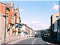
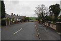
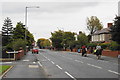
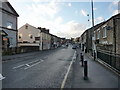
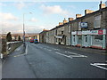
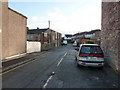
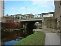
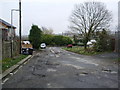
Photos of BB1 4NU


Area Information
Living in BB1 4NU means being part of a tightly knit residential cluster in the heart of Rishton, Lancashire. With a population of 1,509 spread over a compact area, this postcode reflects a mature community where 1211 people live per square kilometre. Situated 4 miles north-east of Blackburn and 2 miles west of Clayton-le-Moors, the area is steeped in history, from its 19th-century canal routes to its role in the cotton industry. Daily life here balances proximity to urban amenities with a quieter, residential rhythm. The ward’s small size means residents share a shared sense of community, with local landmarks like Rishton Reservoir and the Leeds and Liverpool Canal adding character. While the area lacks sprawling green spaces, its transport links to nearby towns and practical amenities like Co-op and Morrisons ensure convenience. BB1 4NU is not a place for those seeking isolation, but it suits those who value accessibility and a well-established local identity.
- Area Type
- Postcode
- Area Size
- Not available
- Population
- 1509
- Population Density
- 1211 people/km²
The property market in BB1 4NU is characterised by a 53% home ownership rate, with houses forming the majority of the accommodation stock. This suggests a market skewed toward owner-occupied properties rather than rentals, which may indicate a stable, long-term resident base. The small size of the area means housing stock is limited, and buyers should expect a competitive environment for available homes. The predominance of houses over flats or apartments may appeal to those seeking more space or privacy, though the high population density (1211 people/km²) hints at compact, efficient use of land. For buyers, this small postcode area’s immediate surroundings offer limited alternatives, making location and condition critical factors. The market is unlikely to cater to transient or short-term needs, aligning with the area’s mature demographic.
House Prices in BB1 4NU
No properties found in this postcode.
Energy Efficiency in BB1 4NU
Residents of BB1 4NU have access to a range of nearby amenities, including five retail spots such as Co-op Rishton, Morrisons Great, and Co-op Pickup, ensuring daily shopping needs are met within easy reach. The area’s transport links, with five railway stations, provide swift access to larger towns like Blackburn and Accrington, where additional leisure and dining options are available. While the data does not mention parks or recreational facilities, the historical presence of the Leeds and Liverpool Canal and Rishton Reservoir adds a layer of natural interest. The compact nature of the area means residents can walk or cycle to local shops and services, fostering a sense of convenience. The mix of retail and transport options supports a lifestyle that balances local independence with regional connectivity.
Amenities
Schools
| Rank | School | Type | Entry gender | Ages |
|---|
Explore more schools in this area
Go to Schools tabDemographics
The community in BB1 4NU is predominantly composed of adults aged 30–64, with a median age of 47. This suggests a population skewed toward middle-aged individuals, likely including families and professionals. Home ownership stands at 53%, with houses being the primary type of accommodation, indicating a stable, settled demographic. The predominant ethnic group is White, reflecting the broader regional profile. While no specific data on deprivation is provided, the high proportion of owner-occupied homes and the age distribution suggest a community with established roots. However, the absence of detailed diversity metrics means the full scope of cultural or socioeconomic variation remains unexplored. The age profile also implies a population less reliant on schools for younger children, though nearby schools would still be a practical consideration for families.
Household Size
Accommodation Type
Tenure
Ethnic Group
Religion
Household Composition
Age
Household Deprivation
NS-SEC
Explore more demographic insights in this area
Go to Demographics tabPlanning
Planning Constraints
- Flood RiskPremium
- Ramsar Wetland SitesPremium
- Area of Outstanding Natural BeautyPremium
- Protected Nature ReservePremium
- Protected WoodlandPremium