Area Overview for BB1 3EU
Photos of BB1 3EU
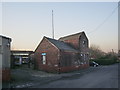
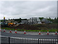
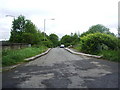
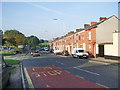
63 photos from this area
Area Information
Key information about the BB1 3EU including its size, population, and administrative classification.
- Area Type
- Postcode
- Area Size
- 14.7 hectares
- Population
- 1758
- Population Density
- 2322 people/km²
House Prices in BB1 3EU
14
Properties
£75,242
Average Sold Price
£45,000
Lowest Price
£137,000
Highest Price
Showing 14 properties
| Address | Type | Beds | Baths | Last Sale Price | Last Sale Date | |
|---|---|---|---|---|---|---|
| 26-28 Gorse Street, Blackburn, BB1 3EU | Terraced | 3 | 1 | £137,000 | Jun 2023 | |
| 22 Gorse Street, Blackburn, BB1 3EU | house | - | - | £45,000 | Oct 2021 | |
| 32 Gorse Street, Blackburn, BB1 3EU | house | 3 | 1 | £70,000 | Dec 2015 | |
| 34 Gorse Street, Blackburn, BB1 3EU | house | 4 | 1 | £65,000 | Oct 2014 | |
| 30 Gorse Street, Blackburn, BB1 3EU | house | - | - | £74,950 | Dec 2009 | |
| 36 Gorse Street, Blackburn, BB1 3EU | house | - | - | £59,500 | Jan 2008 | |
| 28 Gorse Street, Blackburn, BB1 3EU | Terraced | 3 | 1 | - | - | |
| Total Insignia Ltd, The Gate House, Imperial Mill, Gorse Street, Blackburn, BB1 3EU | office_workshop | - | - | - | - | |
| Kirk Scaffolding, Greenbank Works, Gorse Street, Blackburn, BB1 3EU | warehouse | - | - | - | - | |
| Burger King, Gorse Street, Blackburn, BB1 3EU | restaurant_cafe | - | - | - | - |
Page 1 of 2
Energy Efficiency in BB1 3EU
Amenities
Schools
| Rank | School | Type | Entry gender | Ages |
|---|
Explore more schools in this area
Go to Schools tabDemographics
Household Size
Family (3-5 people)
most common
Accommodation Type
Houses
most common
Tenure
62
majority
Ethnic Group
asian_total
most common
Religion
N/A
most common
Household Composition
N/A
most common
Age
22
median
Adults (30-64 years)
most common
Household Deprivation
N/A
with no deprivation
NS-SEC
16
in Lower managerial occupations
Explore more demographic insights in this area
Go to Demographics tabPlanning
Planning Constraints
- Flood RiskPremium
- Ramsar Wetland SitesPremium
- Area of Outstanding Natural BeautyPremium
- Protected Nature ReservePremium
- Protected WoodlandPremium