Area Overview for Bastwell & Daisyfield Ward
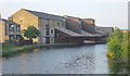
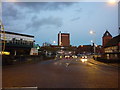
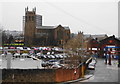
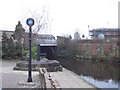
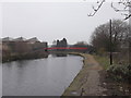
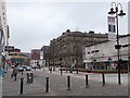
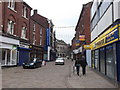
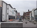
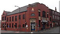
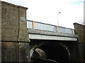
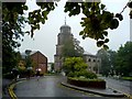
Photos of Bastwell & Daisyfield Ward

Area Information
Living in Bastwell & Daisyfield Ward offers a defined spatial experience within Blackburn with Darwen, covering 95.8 hectares of local area. This electoral ward sits at coordinates 53.750006, -2.46888 and carries the central postcode of BB1 3BE. The population stands at approximately 1,296 residents, creating a setting that feels small yet established. You will find this location centred around specific geographic parameters that distinguish it from neighbouring districts. The ward functions as a distinct unit within the unitary authority, providing a clear sense of place for those seeking to establish roots. Daily life here revolves around the compact footprint of the ward, which encompasses specific boundary lines and local landmarks. Residents navigate this space with a knowledge of its precise dimensions and central position. The area represents a concrete opportunity for those who prefer defined neighbourhoods over sprawling urban expansions. Your daily commute or local walks remain contained within these recognized boundaries of Blackburn with Darwen. The enclosure of the ward provides a tangible framework for understanding your immediate environment. You can expect a setting where the scale of the community matches the physical size of the 95.8 hectares. This specific location allows for a clear understanding of what lies within your daily reach.
- Area Type
- District Borough Unitary Ward
- Area Size
- 95.8 hectares
- Population
- Not available
- Population Density
- Not available
Demographics
The community of Bastwell & Daisyfield Ward displays a clear age profile with a median age of 70. Most residents fall into the older demographic categories, meaning you will encounter a population that has lived in Blackburn with Darwen for a long time. Household composition reflects this elder majority, as the data tracks total categories for the whole ward. Approximately 55% of households own their homes outright or via mortgage, indicating a significant level of stability among inhabitants. The remaining portion of households are renting or living in other arrangements within the ward. Accommodation types are recorded but not detailed, suggesting a mix suitable for various needs across the 1,296 population. Ethnic diversity is tracked by total metrics, while religious affiliations are also recorded in aggregate. This demographic makeup means the area has served its current generation well, with older people forming the core of daily life. You are looking at a community where home ownership provides the majority with security, while nearly half live in rented properties. The age distribution ensures a calm atmosphere where established residents dominate the local scene. Understanding these figures helps you gauge the type of neighbours you might meet when walking through the streets of this ward.
Household Size
Accommodation Type
Tenure
Ethnic Group
Religion
Household Composition
Age
Household Deprivation
NS-SEC
Explore more demographic insights in this area
Go to Demographics tabPlanning
Planning Constraints
- Flood RiskPremium
- Ramsar Wetland SitesPremium
- Area of Outstanding Natural BeautyPremium
- Protected Nature ReservePremium
- Protected WoodlandPremium
- Crime RiskPremium