Area Overview for Barnoldswick
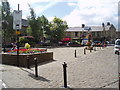
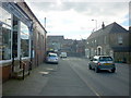
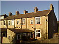
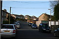
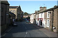
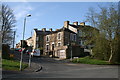
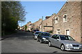
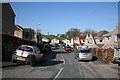
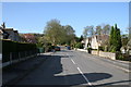
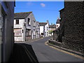
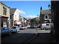
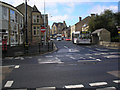
Photos of Barnoldswick
Area Information
Barnoldswick is a built-up area in Lancashire, covering an area of 2.4 square kilometres. You will find this neighbourhood fits comfortably into a larger town setting rather than sprawling outwards. The compact nature of the area means your daily movements are short and efficient. Most residents access their essential needs without needing to travel far from their doorstep. Living in Barnoldswick offers a sense of stability grounded in a defined community space. The town functions as a self-contained unit where local commerce and transport hubs operate within close proximity to housing stock. You can expect a environment where the distance between your home and local services remains manageable throughout the week. This specific geography supports a lifestyle that values practicality over extended commutes. The structure of the area allows for a straightforward relationship between where you live and where you do your shopping or catch your train. Your experience of daily life is shaped by this concentrated layout which removes many of the uncertainties found in larger, more dispersed urban sprawls.
- Area Type
- Built Up Area 250
- Area Size
- 2.4 km²
- Population
- Not available
- Population Density
- Not available
Your daily lifestyle in Barnoldswick revolves around a compact set of accessible amenities. You can reach several retail outlets including Co-op Barnoldswick, Spar, and Aldi Barnoldswick, ensuring your grocery and essential shopping needs are met locally. These three specific chains provide a familiar and convenient environment for your weekly shop. Transport connections rely heavily on three key railway stations: Colne Railway Station, Gargrave Railway Station, and Nelson Railway Station. These stations offer practical rail links for residents needing to travel beyond the immediate town limits. The presence of these three stations gives you flexibility in choosing departure times and destinations based on your schedule. Living in Barnoldswick grants you direct access to these retail and transport nodes without extensive travel planning. The concentration of these amenities within practical reach supports a self-sufficient lifestyle where you can manage most daily tasks locally. You do not need to venture far to find the essentials for your home and commute.
Amenities
Schools
Families living in Barnoldswick have access to a range of local educational institutions. The area hosts five named primary schools within its vicinity. Gisburn Road Community Primary School holds a good Ofsted rating, providing verified quality for parents. Coates Lane Primary School also carries a good Ofsted rating, further reinforcing the presence of high-standard education options. Rainhall Road Community Primary School is another local option available for families. Barnoldswick Church of England Controlled Primary School operates under controlled Christian faith principles with a good Ofsted rating, appealing to those seeking faith-based education. St Joseph's Catholic Primary School, Barnoldswick serves the Catholic community within the locality. While specific secondary schools are not listed in the immediate proximity data, the presence of multiple primary providers with strong regulatory ratings ensures that younger children have access to quality instruction. The mix of community-led, church-controlled, and faith-specific schools offers variety in curriculum and ethos. You will find that the concentration of primary schools supports local catchment areas effectively without the need for long-distance commuting for early education.
| Rank | School | Type | Entry gender | Ages |
|---|
Explore more schools in this area
Go to Schools tabDemographics
The community within Barnoldswick reflects a mature population profile. You will find that 72 per cent of households here are owned outright, indicating a strong sense of long-term settlement among residents. This high level of home ownership suggests stability valued by the largest group in the area. The demographic data points to a median age of 70, revealing a community where older generations form a significant portion of the population structure. You will notice that the most common age grouping aligns with this higher median age figure, shaping local interactions and service requirements. Accommodation types reflect the tenure structure with a predominance of owner-occupied properties within the area's boundaries. While specific details on household composition and predominant ethnic groups are recorded in the dataset, the clear signal is the economic stability of those residing here. The age profile indicates that local services and leisure facilities likely cater to older demographics. When you consider demographic factors for living in Barnoldswick, the data confirms a neighbourhood where retirement and mature living are central themes. The housing stock and community makeup support a quieter, more settled way of life compared to youthful urban hubs.
Household Size
Accommodation Type
Tenure
Ethnic Group
Religion
Household Composition
Age
Household Deprivation
NS-SEC
Explore more demographic insights in this area
Go to Demographics tabPlanning
Planning Constraints
- Crime RiskPremium