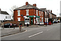
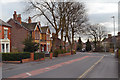
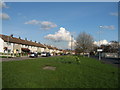
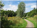
Area Overview for Bankfield Ward
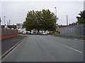
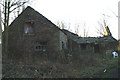
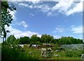
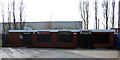
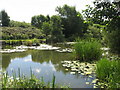
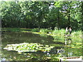
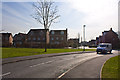
Photos of Bankfield Ward

Area Information
Bankfield Ward is a compact district covering just 1.4 square kilometres. Despite its small footprint, the ward houses a population of 1,590 residents. You will find this area is densely packed with people, holding a population density of 1,119 people per square kilometre. This concentration means that daily life here revolves closely around immediate neighbourhoods without much sprawling space. The location sits within the broader administrative framework of a borough unitary ward in England. Because the geography is so limited, you walk rather than drive for many essential errands. The centralised nature of Bankfield Ward creates a tight-knit environment where facilities are frequently within stepping distance. There are no large architectural barriers or significant planned constraints within the boundaries. You do not face obstacles related to protected nature reserves or special planning designations when navigating the land. The small scale ensures that everyone knows everyone quickly, fostering a sense of familiarity. Living in Bankfield Ward offers a straightforward routine where the start and end points are always visible. This density supports a tight schedule but may limit the quiet escape you find in larger districts. The size dictates that noise and activity from neighbours affect daily life more directly than in expanded areas. You trade expansive scenery for convenience and proximity in this specific ward.
- Area Type
- District Borough Unitary Ward
- Area Size
- 1.4 km²
- Population
- 1590
- Population Density
- 1119 people/km²
Demographics
Understanding the community in Bankfield Ward requires looking closely at the age distribution. The median age stands at 70, indicating a population where older residents form the core of the community. You will find that the demographic makeup is dominated by individuals in the later stages of life compared to the national average. Nothing suggests a wide variation within the total age grouping, reinforcing the stationary nature of the resident base. Home ownership is a defining feature of daily life here, with 62% of residents owning their properties outright. This figure places the area firmly in the owner-occupied category rather than the rental market. You can expect a local vote bank heavily weighted towards those who have already settled in for the long haul. The household composition data does not highlight temporary or transient living arrangements as a primary characteristic. There is no data available regarding ethnic groups or religious affiliations within the provided statistics. You should not anticipate significant demographic shifts driven by incoming younger families at this stage. The stability of the population creates a predictable social environment. Deprivation levels are not quantified in the current data, so you cannot measure economic disparity directly. However, the high ownership rate generally signals financial stability among those present. When living in Bankfield Ward, neighbours tend to be long-term residents who have made a permanent commitment to the locality.
Household Size
Accommodation Type
Tenure
Ethnic Group
Religion
Household Composition
Age
Household Deprivation
NS-SEC
Explore more demographic insights in this area
Go to Demographics tabPlanning
Planning Constraints
- Flood RiskPremium
- Ramsar Wetland SitesPremium
- Area of Outstanding Natural BeautyPremium
- Protected Nature ReservePremium
- Protected WoodlandPremium
- Crime RiskPremium