Area Overview for Baguley Ward
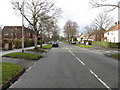
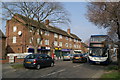
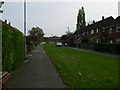
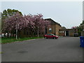
Photos of Baguley Ward

Area Information
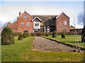
Baguley Ward occupies a 3.8 km² district in the south-west of Greater Manchester, representing a compact yet historically significant community within the unitary borough. With a population of 1,781, this area forms part of a broader urban landscape that originally included the historic Cheshire border before integrating fully into Greater Manchester. The location sits approximately at coordinates 53.390°N, 2.285°W, placing it in a setting shaped by centuries of development. You will find yourself living in an environment where modern urban density meets ancient heritage, anchored by Baguley Hall, a Grade I listed building and Scheduled Ancient Monument dating back to the 14th century. This timber-framed manor, constructed by Sir William de Baguley, retains architectural features influenced by Danish Viking boat-building methods. The history of the site extends through the Legh family's 400-year ownership to its current role as farm buildings and the former location of Baguley Sanatorium. Today, the ward encompasses the site of Wythenshawe Hospital, which developed from the sanatorium founded in 1902 to combat tuberculosis. Residents live in a neighbourhood defined by its deep historical roots and its transformation into a key healthcare facility.
- Area Type
- District Borough Unitary Ward
- Area Size
- 3.8 km²
- Population
- 1781
- Population Density
- 464 people/km²
Demographics
The community profile within Baguley Ward reveals a distinct age demographic with a median age of 70 years. This indicates a population heavily weighted toward older residents, shaping the daily rhythm of the neighbourhood. The data identifies the most common age range as "Age: Total", reflecting the broad spread of this senior-heavy cohort. With 43% home ownership rates, more than half of the residents rent their homes, suggesting a significant portion of the population relies on social housing or rental markets rather than private property investment. Accommodation types across the ward reflect this mix, though specific breakdowns of dwelling styles are not detailed in the available figures. The population density stands at 464 people per square kilometre, creating a residential feel that is neither suburban nor high-rise urban. This density contributes to a close-knit but potentially crowded living environment typical of established urban wards. You should expect a community where services are tailored to the needs of an older, predominantly renting population. The historical context of the area, evolving from agricultural estates to medical facilities, likely influenced the tenure and age structure of its current residents.
Household Size
Accommodation Type
Tenure
Ethnic Group
Religion
Household Composition
Age
Household Deprivation
NS-SEC
Explore more demographic insights in this area
Go to Demographics tabPlanning
Planning Constraints
- Flood RiskPremium
- Ramsar Wetland SitesPremium
- Area of Outstanding Natural BeautyPremium
- Protected Nature ReservePremium
- Protected WoodlandPremium
- Crime RiskPremium