Area Overview for Atherton
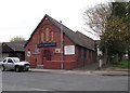
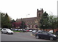
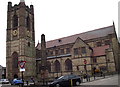
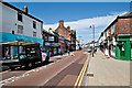
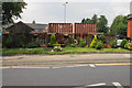
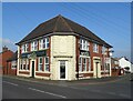
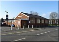
Photos of Atherton

Area Information
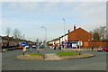
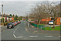
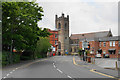
Atherton is a distinct built-up area in England, embracing a population of 3,545 residents across a compact 5.9 km². This relatively small footprint creates a close-knit environment where neighbours often know one another. You will find a community defined by high home ownership rates, suggesting a stable population of long-term residents rather than transient tenants. The area functions as a locality within a larger urban context, offering the convenience of town life without the sprawl of a major metropolis. Daily life for living in Atherton revolves around accessibility to local train stations and key retail hubs. You can reach major supermarkets like Asda Atherton and Morrisons Daily Atherton easily, alongside the historic heritage site known as Heron Hag. The presence of multiple railway stations, including Atherton Railway Station and Hag Fold Railway Station, positions the locality for commuters. City Airport Manchester is within practical reach, providing options for private aviation or business travel. The median age of 70 indicates a mature demographic, which shapes the character of the neighbourhood and the demand for specific housing types. You are dealing with an established area where housing stock and services cater to older generations.
- Area Type
- Built Up Area 250
- Area Size
- 5.9 km²
- Population
- 3545
- Population Density
- 605 people/km²
Your daily life in Atherton is centred on convenient access to essential amenities and leisure spots. The retail scene offers a practical choice of shopping options without the need to travel far. You can visit Morrisons Daily Atherton for a quick grocery stop or head to Asda Atherton for a larger weekly shop. Heritage enthusiasts will find Heron Hag a significant local landmark, offering history and character in the heart of the town. Transport links bring further lifestyle benefits, with five rail stations in close proximity making commutes straightforward. Daisy Hill Railway Station provides another convenient interchange point for your daily journey. For those who prefer flying, City Airport Manchester is nearby, opening up travel possibilities for business or leisure. The layout of these amenities means you do not need to commute to a larger city centre for basic needs. Shopping, banking, and socialising happen within a manageable radius from your home. The concentration of these facilities supports a self-sufficient lifestyle where most errands are completed locally. You enjoy the convenience of having major supermarkets and historical sites within easy reach, avoiding the rush of distant urban centres. This balance of convenience and local charm defines the residential experience in Atherton.
Amenities
Schools
Families seeking schools near Atherton have access to several well-rated primary institutions, though the demographic skew towards older residents means these venues serve a specific market. Within walking or short driving distance, you will find St Andrew's CofE Primary School, Over Hulton, which holds a good Ofsted rating. Meadowbank Primary School & Children's Centre also carries a good rating, offering integrated education and care services. Parklee Community School boasts a good rating, providing a maintained school option for the locality. For parents prioritising the highest standard, Hindsford CofE Primary School stands out with an outstanding Ofsted rating, representing the academic excellence available just outside the immediate boundaries. Chowbent Primary School rounds out the list with a good rating. While there are no secondary schools listed in the immediate vicinity data, the presence of five primary schools suggests a network of early education support. The mix includes Church of England schools like St Andrew's and Hindsford, as well as community schools like Parklee. If you are considering moving to the area, you have the option of selecting an outstanding provision like Hindsford or settling for a good standard at the other listed venues. The Ofsted ratings confirm that education standards in the surrounding area remain high across all listed primary providers.
| Rank | School | Type | Entry gender | Ages |
|---|
Explore more schools in this area
Go to Schools tabDemographics
The community in Atherton is defined by a highly mature demographic profile. The median age stands at 70 years, reflecting an older population where the vast majority of residents are seniors. This age distribution means that children and young families make up a smaller proportion of the total population compared to other parts of Greater Manchester. With 65 per cent of the population in home ownership, you are looking at a predominantly owner-occupied area. This high rate suggests that most households have remained in their properties for significant periods, contributing to the stable social fabric. There is a clear preference for settling down long-term rather than renting, which often leads to higher maintenance standards and cared-for surroundings. The household composition data points towards a community where single households or couples without dependent children are common. While specific figures on household size are not broken down in the provided data, the dominant age range supports the notion of an area suited to retirement or semi-retirement living. You will not find a bustling scene of young professionals or large families with school-aged children as the primary demographic. Instead, daily life revolves around the needs and interests of an older, settled community.
Household Size
Accommodation Type
Tenure
Ethnic Group
Religion
Household Composition
Age
Household Deprivation
NS-SEC
Explore more demographic insights in this area
Go to Demographics tabPlanning
Planning Constraints
- Crime RiskPremium