Area Overview for Ashton upon Mersey Ward
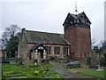
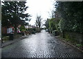
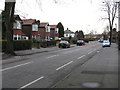
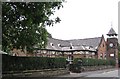
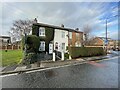
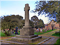
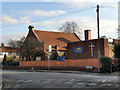
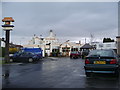
Photos of Ashton upon Mersey Ward


Area Information
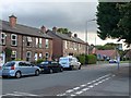
Ashton upon Mersey Ward represents a compact, settled district in the United Kingdom. The area covers just 2.3 square kilometres, creating an intimate living environment. You will find a population of 1,442 residents concentrated within these small boundaries. This results in a population density of 627 people per square kilometre, which indicates a neighbourhood that feels close-knit without being overwhelmingly urban. Living in Ashton upon Mersey Ward offers a sense of locality driven by its manageable size. The ward functions as a distinct unit within the broader borough structure, providing clear geographic boundaries for homebuyers. Daily life here is shaped by a high concentration of residents in a limited footprint. You experience a community where neighbours are likely to know one another due to the relatively small total population. This density supports local engagement while maintaining a residential focus. The area remains accessible and defined, making it easy to navigate on foot or by bicycle. Its status as a unitary ward council area ensures specific local governance structures are in place for Ashton upon Mersey Ward.
- Area Type
- District Borough Unitary Ward
- Area Size
- 2.3 km²
- Population
- 1442
- Population Density
- 627 people/km²
Demographics
The community profile in Ashton upon Mersey Ward reflects a mature population structure. The median age of residents is 70 years old. This figure indicates that the area is significantly older than the national average for the United Kingdom. You will encounter a demographic dominated by retirees and older adults living in Ashton upon Mersey Ward. The most common age range covers the total population, suggesting a steady decline in younger age cohorts. Home ownership stands at 75 per cent, which is a substantial figure for the region. This percentage demonstrates that the majority of households in Ashton upon Mersey Ward own their properties outright or with a mortgage. Rental forms of tenure make up the remaining quarter of the housing market. Household composition data provides a complete picture of how families and individuals organise their living arrangements within the ward. Accommodation types span the various dwellings available across the 2.3 square kilometres. The high ownership rate combined with the older median age points to a settlement that has seen limited new construction in recent decades. This demographic reality influences local service usage and community engagement patterns for residents of Ashton upon Mersey Ward.
Household Size
Accommodation Type
Tenure
Ethnic Group
Religion
Household Composition
Age
Household Deprivation
NS-SEC
Explore more demographic insights in this area
Go to Demographics tabPlanning
Planning Constraints
- Flood RiskPremium
- Ramsar Wetland SitesPremium
- Area of Outstanding Natural BeautyPremium
- Protected Nature ReservePremium
- Protected WoodlandPremium
- Crime RiskPremium