Area Overview for Ashton-in-Makerfield South Ward
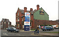
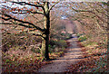
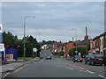
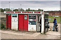
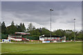
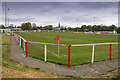
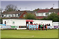
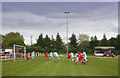
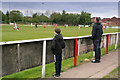
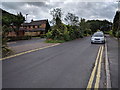
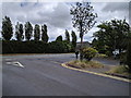
Photos of Ashton-in-Makerfield South Ward
Area Information
Living in Ashton-in-Makerfield South Ward means residing within a 3.8 km² district that forms part of the Metropolitan Borough of Wigan in Greater Manchester. This ward sits south of Wigan and west of Leigh, anchoring the Makerfield UK Parliament constituency. You are in a primarily residential zone where the character shifts gently from dense suburbia to pockets of semi-rural land. The area retains its industrial roots as a former coal-mining locality, now hosting small amounts of light industry alongside new housing developments. Residents here enjoy a worked-class demographic profile with higher rates of home ownership compared to surrounding boroughs. The southward position places you near key green buffers that separate the built environment from open space. Daily life revolves around a stable, established community where neighbours often know one another. The geography offers coordinates of approximately 53.49°N and 2.63°W, marking its specific location in North West England. While the economy has evolved from heavy mining, it continues to support local light industry jobs. You find yourselves in a setting that balances working-class heritage with ongoing residential growth. The ward does not feature the grandeur of a city centre but provides the quiet and space of a residential suburb. This distinction matters if you seek stability without the density of larger urban hubs. The area remains accessible via road networks that connect Leigh and Wigan, serving as a vital link for commuters and families alike.
- Area Type
- District Borough Unitary Ward
- Area Size
- 3.8 km²
- Population
- Not available
- Population Density
- Not available
Demographics
The community in Ashton-in-Makerfield South Ward displays a distinct demographic profile centred on older households. The median age reaches seventy years, indicating a population that is significantly older than the national average. This age structure suggests you will be living among retired residents or those nearing retirement, rather than young families building careers. Household composition follows this older trend, with fewer single-person or multi-children households than you might find in younger urban zones. Home ownership stands at an impressive 81 percent within the ward. This figure confirms a strong preference for owning rather than renting your property. You can expect a neighbourhood where residents have long-term ties to their homes, contributing to a stable social fabric. The high ownership rate also reflects a skilled working-class population that values asset accumulation. Accommodation types mirror this settled nature, though specific data on flat versus house distribution is limited to the total occupancy picture. Regarding diversity, the provided data does not specify ethnic groups or religious affiliations. The community remains focused on its core demographic profile. Deprivation levels show a lower score compared to neighbouring areas within the metropolitan borough. This lower deprivation indicates better access to services and a higher quality of life. You are entering an area where financial stability is more common, which supports local trade and community maintenance. The demographic reality is one of mature, settled living defined by ownership and age.
Household Size
Accommodation Type
Tenure
Ethnic Group
Religion
Household Composition
Age
Household Deprivation
NS-SEC
Explore more demographic insights in this area
Go to Demographics tabPlanning
Planning Constraints
- Flood RiskPremium
- Ramsar Wetland SitesPremium
- Area of Outstanding Natural BeautyPremium
- Protected Nature ReservePremium
- Protected WoodlandPremium
- Crime RiskPremium