Area Overview for Ashton-in-Makerfield
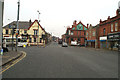
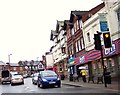
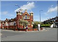
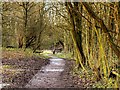
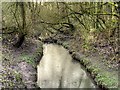
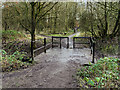
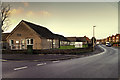
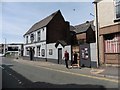
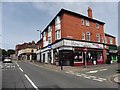
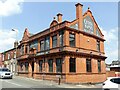
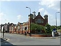
Photos of Ashton-in-Makerfield
Area Information
Ashton-in-Makerfield stands as a significant built-up area within England, functioning as a recognised town rather than a sprawling metropolis. You will find a community defined by its established character, offering a residential rhythm that balances accessibility with local identity. Living here means engaging with a neighbourhood that has developed distinct patterns of daily life, drawing residents who value the interconnected nature of its streets. The area does not boast vast geographical dimensions, which often translates to shorter commutes between homes and local amenities. This compactness fosters a sense of familiarity, allowing you to navigate your surroundings without the disorientation common in larger cities. Ashton-in-Makerfield provides a stable backdrop for family life, where the built environment supports consistent routines. While the specific population figures are not detailed in the current profile, the designation as a built-up area suggests a moderate density suitable for those seeking a town centre experience without urban congestion. Your daily interactions here are shaped by the proximity of services and the established layout of the locality. Homes in Ashton-in-Makerfield cater to individuals prioritising a settled atmosphere over the constant flux of major urban hubs. The physical infrastructure supports a lifestyle where local facilities remain within easy reach, reinforcing the practicality of choosing this specific location for your residence.
- Area Type
- Built Up Area 250
- Area Size
- 6.7 km²
- Population
- 3206
- Population Density
- 482 people/km²
Amenities
Schools
Your children's education options in Ashton-in-Makerfield include several primary institutions with varying Ofsted ratings that provide a concrete picture of educational quality. Garswood Primary and Nursery School holds an outstanding Ofsted rating, offering you a top-tier educational choice for young families in the neighbourhood. Nicol Mere School also achieves an outstanding rating, reinforcing the area's commitment to high standards in primary education. You have additional choices with R L Hughes Primary School, which carries a good Ofsted rating, providing a solid middle tier for your child's schooling. Rectory CofE Primary School holds a satisfactory rating, presenting another option within the local catchment area. Gerard RC Infant School appears in the list of nearby institutions without an Ofsted rating currently displayed in the data. This mix of school types means you have access to non-denominational, Church of England, and Roman Catholic institutions depending on your family's preferences and religious requirements. The presence of two outstanding-rated schools highlights a concentration of quality education within Ashton-in-Makerfield. Schools near Ashton-in-Makerfield are predominantly primary establishments, suggesting that further education facilities are located adjacent to or within this built-up area. When evaluating homes in Ashton-in-Makerfield, proximity to Garswood Primary and Nursery School or Nicol Mere School could significantly enhance the value of the property for families prioritising academic performance.
| Rank | A + A* % | School | Type | Entry gender | Ages |
|---|---|---|---|---|---|
| 1 | N/A | Garswood Primary and Nursery School | primary | N/A | N/A |
| 2 | N/A | Rectory CofE Primary School | primary | N/A | N/A |
| 3 | N/A | Gerard RC Infant School | primary | N/A | N/A |
| 4 | N/A | R L Hughes Primary School | primary | N/A | N/A |
| 5 | N/A | Nicol Mere School | primary | N/A | N/A |
Explore more schools in this area
Go to Schools tabDemographics
The community profile of Ashton-in-Makerfield relies on published assessments regarding safety and living conditions to define the resident experience. You can place a high degree of confidence in the area's safety record based on available metrics. The Crime Risk assessment assigns a score of 70 out of 100, with lower scores indicating less risk. This low crime risk classification confirms that Ashton-in-Makerfield operates as a safer neighbourhood compared to the broader average for the country. For you, this statistic translates into a practical assurance of security while walking along your street or returning from local shops. The data indicates that crime rates here fall below the national benchmark, suggesting a dependable environment for raising children or pursuing leisure activities in public spaces. This safety profile is a concrete fact you can utilise when evaluating the long-term viability of moving into Ashton-in-Makerfield. The deprivation levels are not explicitly quantified in the current dataset, meaning you cannot calculate income thresholds or specific poverty rates. However, the security rating provides a robust indicator of the quality of life, separating this area from regions known for higher instability. You are assured that the primary security concerns affecting most residents are minimal according to the 70-point risk score. This factual basis allows you to make a decision grounded in verifiable safety statistics rather than speculation about local conditions.
Household Size
Accommodation Type
Tenure
Ethnic Group
Religion
Household Composition
Age
Household Deprivation
NS-SEC
Explore more demographic insights in this area
Go to Demographics tabPlanning
Planning Constraints
- Crime RiskLocked