Area Overview for Ashton Ward
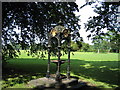
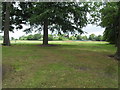
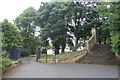
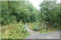
Photos of Ashton Ward

Area Information
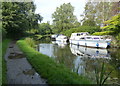
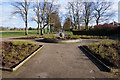
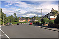
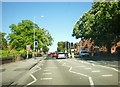
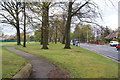
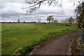
Ashton Ward sits as a distinct district within the borough unitary authority of Ashton upon Mersey. This compact residential zone covers an area of 3.8 km², creating a dense and defined neighbourhood for those seeking homes in this specific location. Living in Ashton Ward means inhabiting a place where community ties are likely deep due to the high proportion of owner-occupied properties. The area caters to a particular demographic profile, with a population skewed significantly towards older residents. A median age of 70 years characterises the community, suggesting a quiet environment suitable for retirement living rather than family growth. Daily life here revolves around local amenities within close proximity, supported by exceptional digital infrastructure. Residents benefit from a fixed broadband quality score of 96, ensuring robust connectivity for remote work or leisure activities despite the area's older demographic. While the demographics indicate a settled population, the small footprint of 3.8 km² means that essential services are theoretically within walking distance for many. Prospective buyers must weigh the advantages of a cohesive, older community against the specific environmental risks present in the ward.
- Area Type
- District Borough Unitary Ward
- Area Size
- 3.8 km²
- Population
- Not available
- Population Density
- Not available
Demographics
The community in Ashton Ward is defined by a very specific age profile and ownership structure. With a median age of 70, this area is distinctly older than the national average. This demographic reality shapes the type of amenities available and the general pace of life in the ward. Home ownership stands at 61%, indicating that the majority of households buy rather than rent. This high level of ownership typically suggests a stable, established community where residents have long-term ties to their properties. The household composition and predominant ethnic group data are provided in the dataset but do not reveal specific percentages beyond the home ownership figure. You must understand that a median age of 70 implies that schools near Ashton Ward may not serve the typical local population, as the residents are likely empty-nesters or retirees. This demographic focus means the area functions differently from younger, family-centric districts. The 61% ownership rate also suggests that retirement communities or bungalows may be common, catering to the needs of the 70+ population. If you require a family-oriented environment with young children nearby, Ashton Ward may not align with those needs due to its age distribution.
Household Size
Accommodation Type
Tenure
Ethnic Group
Religion
Household Composition
Age
Household Deprivation
NS-SEC
Explore more demographic insights in this area
Go to Demographics tabPlanning
Planning Constraints
- Flood RiskPremium
- Ramsar Wetland SitesPremium
- Area of Outstanding Natural BeautyPremium
- Protected Nature ReservePremium
- Protected WoodlandPremium
- Crime RiskPremium