Area Overview for Arundel Ward
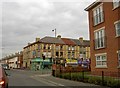
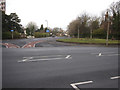
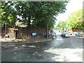
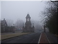
Photos of Arundel Ward


Area Information
Living in Arundel Ward offers a defined residential setting covering 73.6 hectares within the district borough unitary ward. This area presents a clear picture of local life without the ambiguity often found in mixed-use zones. You can expect a small-scale community where the boundaries are well understood, contributing to a predictable environment for daily routines. The ward is situated in England, providing a specific locality for those researching homes in Arundel Ward. Residents here experience a distinct daily rhythm shaped by the relatively compact size of the neighbourhood. While specific population figures are not listed in the available records, the area's classification suggests a focused residential footprint rather than a sprawling urban district. Prospective buyers should note the precise geographic extent of 73.6 hectares as a key identifier when comparing this ward to larger districts. The environment is straightforward, lacking complex planning constraints or major environmental designations that might alter future development potential. This clarity makes Arundel Ward an option for those who prefer a defined territory over a vast, undefined suburban sprawl. Understanding the exact scale of this ward helps you visualise the scope of services and green spaces available to you.
- Area Type
- District Borough Unitary Ward
- Area Size
- 73.6 hectares
- Population
- Not available
- Population Density
- Not available
Demographics
The community in Arundel Ward reflects a significantly older population structure, with a median age of 70 years. This demographic shift indicates a neighbourhood where retirees and older adults form the core of the residential base. You are likely to encounter age groups that are considerably older than the national average, creating a specific social dynamic within homes in Arundel Ward. Household composition data is recorded as total, meaning specific breakdowns into single-person or family units are not explicitly detailed in the provided records. Similarly, data on predominant ethnic groups and religion is available only as total categories, suggesting a homogeneous or unsegmented demographic profile in the current dataset. Home ownership stands at 20%, a figure that places Arundel Ward firmly within the rental sector rather than an owner-occupied market. This low rate of ownership implies that most residents are tenants, which affects social stability and the nature of long-term community integration. The area lacks specific granular data on deprivation levels or income distribution, but the high proportion of renting residents often correlates with lower tenure security. When evaluating schools near Arundel Ward, you must consider that the population median age is skewed towards the elderly, which may influence school enrolment patterns and the types of activities offered to younger residents.
Household Size
Accommodation Type
Tenure
Ethnic Group
Religion
Household Composition
Age
Household Deprivation
NS-SEC
Explore more demographic insights in this area
Go to Demographics tabPlanning
Planning Constraints
- Flood RiskPremium
- Ramsar Wetland SitesPremium
- Area of Outstanding Natural BeautyPremium
- Protected Nature ReservePremium
- Protected WoodlandPremium
- Crime RiskPremium