Area Overview for Appleton Thorn
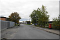
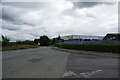
Photos of Appleton Thorn


Area Information
Appleton Thorn is a compact built-up area in England, spanning 1.6 km². It is a place where older residents form the majority, with a median age of 70, suggesting a mature, settled community. The area’s charm lies in its practicality: it is well-connected to nearby towns via rail, with stations such as Warrington Bank Quay and Padgate within reach. Home ownership is high, at 85%, indicating a stable population with long-term residency. Daily life here is shaped by proximity to essential services, including retail hubs like M&S Lymm and Tesco Grappenhall, and the presence of Appleton Thorn Primary School, which serves local families. While the area lacks the vibrancy of larger cities, it offers a quiet, low-maintenance lifestyle. Its appeal is clear for those seeking a safe, familiar environment with strong local ties. The combination of good digital connectivity and accessible transport links ensures residents can balance convenience with a slower pace of life.
- Area Type
- Built Up Area 250
- Area Size
- 1.6 km²
- Population
- Not available
- Population Density
- Not available
Appleton Thorn offers a range of nearby amenities, including retail stores such as M&S Lymm, Co-op Dudlow, and Tesco Grappenhall, which provide everyday shopping needs. The presence of multiple rail stations, including Warrington Bank Quay and Padgate, ensures easy access to public transport, making it simple to travel to larger towns or cities. While the data does not mention parks or leisure facilities, the proximity to retail and transport suggests a practical, no-frills lifestyle. The area’s character is defined by its convenience and accessibility, making it ideal for those who value reliable services and a straightforward commute.
Amenities
Schools
Appleton Thorn Primary School is the only named school listed in the data, and it is a primary school. While no Ofsted rating is provided, its presence indicates that the area is suitable for families with young children. The absence of secondary schools or other educational institutions in the data means that students may need to travel to nearby towns for higher education. For parents, this suggests that Appleton Thorn is best suited for those with younger children, but additional research would be needed to understand the full range of educational options available to residents.
| Rank | School | Type | Entry gender | Ages |
|---|
Explore more schools in this area
Go to Schools tabDemographics
The population of Appleton Thorn is predominantly older, with a median age of 70, and the most common age range encompassing all demographics. Home ownership is exceptionally high at 85%, reflecting a community where long-term residency is the norm. The data does not specify household composition or accommodation types, but the overall stability of the area is evident. With no figures provided on ethnic diversity or religious affiliation, it is unclear how varied the community is, though the high home ownership rate suggests a cohesive, settled population. The absence of specific data on deprivation means it is difficult to assess socioeconomic challenges, but the low crime risk and accessible amenities imply a generally comfortable quality of life for residents.
Household Size
Accommodation Type
Tenure
Ethnic Group
Religion
Household Composition
Age
Household Deprivation
NS-SEC
Explore more demographic insights in this area
Go to Demographics tabPlanning
Planning Constraints
- Crime RiskPremium