Area Overview for Anderton
Photos of Anderton
Area Information
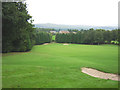
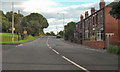
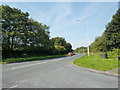
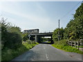
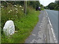
Anderton is a civil parish located within the Borough of Chorley in North West England. It functions as a suburb of Adlington and sits approximately five miles northwest of Bolton. The area covers a compact space of 5.0 km², making it a relatively small community by modern standards. Residents benefit from a deep historical connection, with the settlement originally recorded as Aderton in 1212. The name derives from Old English, suggesting ties to the local landowner, Aethelhere. Historically, this location served as a township within Chorley Rural District before becoming a formal parish prior to 1974. You will find the population stands at about 1,744 people today. This figure reflects a steady, established community rather than a rapidly expanding development zone. The physical layout of the parish has been shaped by significant historical events. Anderton Hall and Lady Hall were once prominent features but are now submerged beneath the waters of the Lower and Upper Rivington Reservoirs. This environmental change defines much of the local landscape. An ancient stone known as the Anderton Stone remains near Rivington Church, carrying carvings that link back to the old chapel. Living in Anderton means embracing a quiet settlement with roots stretching back centuries alongside modern suburban living.
- Area Type
- Parish
- Area Size
- 5.0 km²
- Population
- Not available
- Population Density
- Not available
Demographics
The community profile of Anderton is defined by an older demographic. The median age of residents is 70 years old, indicating a predominantly elderly population. The most common age range corresponds to the total age cohort available in the dataset, reflecting the overall profile of the parish. With so many older residents, you can expect a neighbourhood culture that values stability and established routines. Home ownership is the defining characteristic of this area. Fully 85% of households in Anderton own their homes outright or with a mortgage. This high ownership rate suggests that the local economy supports long-term residents rather than short-term tenants. The low proportion of rental properties aligns with an area favoured by those seeking security. Household composition data indicates a total structure typical of a settled civil parish. While specific breakdowns into single-person or multi-generational households are not detailed in the current figures, the high ownership percentage usually implies families and retirees. Deprivation levels are not quantified in the provided statistics, allowing the area to maintain its own local standing based on property values and tenure. You should expect a community where inheritance and accumulated wealth play a significant role in housing stock. The demographic reality reveals a place designed for permanence.
Household Size
Accommodation Type
Tenure
Ethnic Group
Religion
Household Composition
Age
Household Deprivation
NS-SEC
Explore more demographic insights in this area
Go to Demographics tabPlanning
Planning Constraints
- Flood RiskPremium
- Ramsar Wetland SitesPremium
- Area of Outstanding Natural BeautyPremium
- Protected Nature ReservePremium
- Protected WoodlandPremium
- Crime RiskPremium