Area Overview for Aighton, Bailey and Chaigley
Photos of Aighton, Bailey and Chaigley

Area Information
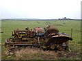
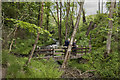
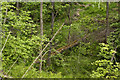
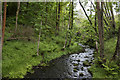
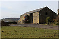
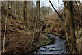
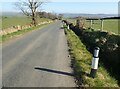
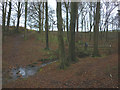
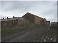
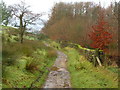
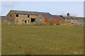
Aighton, Bailey and Chaigley operates as a rural civil parish within the Ribble Valley district of Lancashire. The area encompasses a total land size of 25.5 km² and is centred around Hurst Green. You will find the location defined by its roots as a township formed from three original hamlets, now unified under a single parish designation. Coordinates near postcode BB6 9PU anchor the core of this community, which retains the character of working farmland and historic stone buildings. The landscape offers direct access to walking areas around Longridge Fell and features notably along the Tolkien Trail. Daily life here revolves around a peaceful countryside atmosphere rather than urban bustle. You can explore footpaths that thread through fields and woods, cross Brook waterfalls, and visit historic sites such as Sandy Bridge. The parish includes private grounds and public access routes that keep the setting open and green. Local interest centres on historic landmarks like Bailey Hall and St. John's parish church. Residents who move here are seeking quiet living in an area that balances agricultural heritage with proximity to larger colleges and towns. The population of approximately 1,681 suggests a close-knit environment where community members know one another.
- Area Type
- Parish
- Area Size
- 25.5 km²
- Population
- Not available
- Population Density
- Not available
Demographics
The community profile of Aighton, Bailey and Chaigley reveals a predominantly older population. The median age sits at 70 years, indicating that most residents fall into later life stages. A significant portion of the population consists of retirees or individuals nearing retirement age. With a median age this high, you should expect fewer young families compared to urban districts. The household composition relies heavily on established residents rather than transient populations. Home ownership levels stand at 68% within the parish. This figure confirms that the majority of homes are owned outright or with some degree of equity. You will find it difficult to locate private rental arrangements as the owner-occupier base is substantial. The accommodation stock reflects decades of occupation, meaning many properties have already passed through generations of families. Ethical considerations regarding diversity or religious affiliation do not appear in the available records, suggesting a uniform demographic makeup. The low turnover associated with such a high median age means that local markets remain stable but slow-moving. Your experience of living in this area will be shaped by neighbours who have deep roots in Lancashire history.
Household Size
Accommodation Type
Tenure
Ethnic Group
Religion
Household Composition
Age
Household Deprivation
NS-SEC
Explore more demographic insights in this area
Go to Demographics tabPlanning
Planning Constraints
- Flood RiskPremium
- Ramsar Wetland SitesPremium
- Area of Outstanding Natural BeautyPremium
- Protected Nature ReservePremium
- Protected WoodlandPremium
- Crime RiskPremium