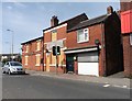
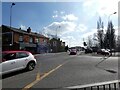
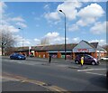
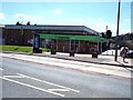
Area Overview for Abram Ward
Photos of Abram Ward

Area Information
Living in Abram Ward offers a distinct character within the Metropolitan Borough of Wigan. This district borough unitary ward covers an area of 13.2 km² and is part of the North West England region. Historically, the area appeared in records as Edburgham in a 1212 survey and existed as a former township. It remains situated within the parish of Wigan and the hundred of West Derby. Currently, the ward contains approximately 5,008 residents. You navigate a community that dates back to the sixteenth century when Royalists held land interests until the 17th century. The area formed part of the Wigan Poor Law Union after 1834 and established a Local Board of Health in 1880 for hygiene and sanitation. In 2015, Wigan Council designated Abram Ward as a Neighbourhood Area and Neighbourhood Forum. This designation gives local residents a formal role in planning decisions. The geography is compact, supporting a population density of 380 people per square kilometre. Daily life here is rooted in this history while managing modern governance structures. Residents engage directly with neighbourhood planning through the established forum.
- Area Type
- District Borough Unitary Ward
- Area Size
- 13.2 km²
- Population
- 5008
- Population Density
- 380 people/km²
Demographics
The community profile of Abram Ward reflects a mature demographic with a median age of 70 years. This statistic indicates that the majority of residents are older adults. The most common age range recorded in the data is labelled as Total, meaning no specific narrow band dominates the distribution beyond the overall median. You find a population that is significantly older than the national average for comparable districts. Home ownership stands at 61% of the total household count. This means nearly two-thirds of households in Abram Ward own their homes outright or have a mortgage. The remaining 39% live in rented accommodation or other non-owned arrangements. Household composition data is aggregated under the total category, preventing a breakdown of single-person versus family units in this specific dataset. The accommodation types are also recorded as a total, without differentiation between detached, semi-detached, or terraced housing. Ethnically and religiously, the data lists the predominant groups simply as total, offering no specific percentages for minority backgrounds or faith affiliations. Despite the high median age, the willingness to own property at a 61% rate suggests long-term stability within the ward boundaries.
Household Size
Accommodation Type
Tenure
Ethnic Group
Religion
Household Composition
Age
Household Deprivation
NS-SEC
Explore more demographic insights in this area
Go to Demographics tabPlanning
Planning Constraints
- Flood RiskPremium
- Ramsar Wetland SitesPremium
- Area of Outstanding Natural BeautyPremium
- Protected Nature ReservePremium
- Protected WoodlandPremium