Area Overview for Above Derwent
Photos of Above Derwent
Area Information
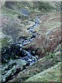
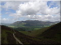
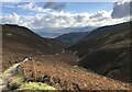
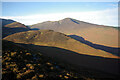
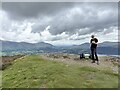
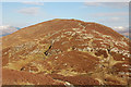
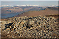
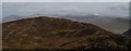
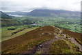
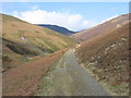
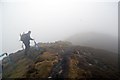
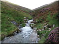
Living in Above Derwent means residing within a distinct civil parish in Cumbria that spans 57.7 square kilometres. This area comprises the ancient townships of Braithwaite, Coledale, Thornthwaite, and the chapelry of Newlands. Historically, the parish formed part of the manor of Braithwaite and Coledale, which lay within the honour of Cockermouth. The settlement dates back to medieval origins, with records of lead and copper mining from the 13th century remaining a part of the local heritage. You will find the parish falls within the ceremonial county of Cumbria and the unitary authority of Cumberland Council, an arrangement established in 2023. Daily life here is shaped by a landscape rich in religious history. Chapels of ease appeared at Thornthwaite and Newlands by the mid-15th and 16th centuries respectively. These communities later transitioned into modern institutions like Braithwaite CE Primary School and the Keswick Orthodox church. The population has evolved from an estimate of 615 individuals in 1688 to approximately 1,200 residents by the late 20th century. While tourism became a significant economic driver from the 1770s, the local economy was historically anchored by hill farming, forestry, and manufacturing, including operations by the Forestry Commission and the Cumberland Pencil Company. Choosing Above Derwent is a choice between a historically deep-rooted community and a rural setting with substantial green space.
- Area Type
- Parish
- Area Size
- 57.7 km²
- Population
- Not available
- Population Density
- Not available
Demographics
The community within Above Derwent reflects a settled and stable population structure. The median age for residents stands at 70 years, indicating a demographic profile heavily weighted toward the older generation. Eighty per cent of residents own their homes outright, suggesting a long-standing attachment to the area and significant household stability. This high level of ownership typically correlates with a slower-paced lifestyle suited to retirement or established living arrangements. The data provided does not detail specific household composition breakdowns or predominant ethnic groups, but the overall picture points to a homogeneous, owner-occupied community. You can expect a neighbourhood where residents have lived for generations. The historical population figures, which rose to 1,115 by 1851 and stabilised between 900 and 1,100 until 1911, support the view of a slowly changing population. The current ownership rate of 78 per cent is notably high compared to national averages, meaning you or a family member are likely dealing with owner-sellers if entering the market. This stability can translate into reliable community engagement, though it may also make it harder for new families to move in quickly without purchasing existing properties. The absence of rental market data implies that transient living is not the norm here.
Household Size
Accommodation Type
Tenure
Ethnic Group
Religion
Household Composition
Age
Household Deprivation
NS-SEC
Explore more demographic insights in this area
Go to Demographics tabPlanning
Planning Constraints
- Flood RiskPremium
- Ramsar Wetland SitesPremium
- Area of Outstanding Natural BeautyPremium
- Protected Nature ReservePremium
- Protected WoodlandPremium
- Crime RiskPremium