Area Overview for Widdrington Station and Stobswood
Photos of Widdrington Station and Stobswood


Area Information
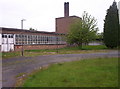
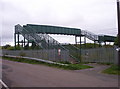
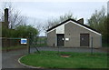
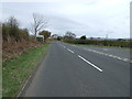
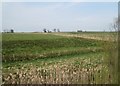
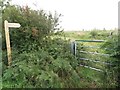
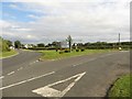
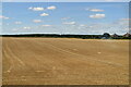
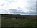
Widdrington Station and Stobswood is a civil parish covering an area of 8.1 km² situated in England. This compact community offers a distinct living environment characterised by its specific planning constraints and established history. Residents here navigate an area defined by particular safety assessments and environmental considerations rather than typical urban density. The parish presents itself as a settled locality where daily life unfolds within clear geographical boundaries. You will find a neighbourhood that has evolved into a specific demographic profile, reflecting long-term stability within a confined space. The location sits within a framework of assessed risks, ranging from low flood potential to specific planning constraints involving protected woodland. This combination of factors shapes the routine of anyone considering homes in Widdrington Station and Stobswood. The area functions as a self-contained parish where the scale of the land directly influences the pace of life. Potential buyers must consider how these defined physical attributes impact their future experience. The character of the landscape and the regulatory environment work together to define the atmosphere. Living here means accepting a rural existence bounded by specific natural and statutory protections. Understanding these foundational elements provides the necessary context for exploring what the neighbourhood offers.
- Area Type
- Parish
- Area Size
- 8.1 km²
- Population
- Not available
- Population Density
- Not available
Demographics
The community in Widdrington Station and Stobswood displays a clear demographic trend towards older residents. The median age stands at 70 years, meaning half the population is older than this figure. This age profile dominates the local landscape and influences how people utilise the parish facilities. Home ownership rates reflect this established population structure with 70% of households owning their property outright. This high level of ownership suggests a stable community where residents have deep ties to the land. The remaining 30% of housing stock consists of rental accommodations, which supports a specific mix of household needs within the parish. The data indicates that the total household composition and accommodation types align with this predominantly owner-occupied model. You will encounter an older demographic rather than families with young children or transient workers. This settlement pattern creates a quiet social environment where neighbours know each other well. The lack of specific data on predominant ethnic groups or religious affiliations does not diminish the clarity of the age distribution. Every claim about the population structure rests on the verified figure of a 70-year median age. This statistical reality defines the social rhythm of Widdrington Station and Stobswood.
Household Size
Accommodation Type
Tenure
Ethnic Group
Religion
Household Composition
Age
Household Deprivation
NS-SEC
Explore more demographic insights in this area
Go to Demographics tabPlanning
Planning Constraints
- Flood RiskPremium
- Ramsar Wetland SitesPremium
- Area of Outstanding Natural BeautyPremium
- Protected Nature ReservePremium
- Protected WoodlandPremium
- Crime RiskPremium