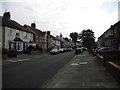
Area Overview for Whitley Bay
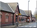
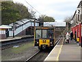
Photos of Whitley Bay


Area Information
Living in Whitley Bay offers a compact, well-defined community within a 7.2 km² area, home to 8,776 residents. The population density of 1,223 people per square kilometre suggests a mix of established neighbourhoods and carefully maintained spaces. With a median age of 70, the area skews older, reflecting a demographic that values stability and proximity to amenities. Whitley Bay’s charm lies in its accessibility—within practical reach are five primary schools, multiple retail outlets, and transport links to nearby towns like Monkseaton and South Shields. The area’s safety score of 73/100, marked as low risk, adds to its appeal for families seeking a secure environment. Daily life here is shaped by proximity to coastal routes, with ferry terminals to Newcastle and South Shields offering easy access to wider regions. The broadband score of 99 ensures seamless connectivity, supporting both remote work and leisure. For those prioritising convenience, Whitley Bay balances quiet living with essential services, making it a viable choice for those seeking a settled, community-focused lifestyle.
- Area Type
- Built Up Area 250
- Area Size
- 7.2 km²
- Population
- 8776
- Population Density
- 1223 people/km²
Whitley Bay’s lifestyle is shaped by its proximity to essential amenities. The area has five retail outlets, including Spar, Morrisons West, and Co-op Whitley, providing everyday shopping convenience. For transport, residents can access ferry terminals in South Shields and Newcastle, as well as rail stations in Monkseaton and Whitley Bay. The presence of five primary schools with good Ofsted ratings ensures families have quality education options nearby. While the data does not list parks or leisure facilities explicitly, the area’s coastal location likely offers outdoor activities. The mix of retail, transport, and educational options creates a self-contained environment, reducing the need for long commutes. This balance of practicality and accessibility makes daily life in Whitley Bay efficient and comfortable for residents.
Amenities
Schools
Whitley Bay is served by five primary schools, each with a good Ofsted rating. These include Rockcliffe First School, Appletree Gardens First School, Southridge First School, and South Wellfield First School, all of which provide quality education for younger children. The presence of multiple primary schools with consistent ratings suggests a strong local education network, particularly for families with young children. While no secondary schools are listed in the data, the proximity to nearby towns may offer additional options. The good ratings across all primary schools indicate a focus on educational standards, which is a key consideration for families prioritising schooling. The variety of school names and locations within the area also suggests that parents have choices in terms of proximity and school culture.
| Rank | A + A* % | School | Type | Entry gender | Ages |
|---|---|---|---|---|---|
| 1 | N/A | Day Tutorial Unit | other | N/A | N/A |
| 2 | N/A | Rockcliffe First School | primary | N/A | N/A |
| 3 | N/A | Appletree Gardens First School | primary | N/A | N/A |
| 4 | N/A | Southridge First School | primary | N/A | N/A |
| 5 | N/A | South Wellfield First School | primary | N/A | N/A |
Explore more schools in this area
Go to Schools tabDemographics
Whitley Bay’s population has a median age of 70, indicating a predominantly older demographic. This aligns with the area’s home ownership rate of 80%, suggesting many residents are long-term residents or retirees. The data does not specify household composition or ethnic diversity, but the population density of 1,223 people per km² implies a mix of single-person and family households. With no explicit figures on deprivation or income levels, it is unclear how economic factors influence quality of life. However, the presence of five primary schools with good Ofsted ratings and multiple retail options suggests infrastructure tailored to the needs of an older population. The area’s safety score of 73/100, described as low risk, further supports the idea of a stable, low-pressure environment. For those considering Whitley Bay, the demographic profile highlights a community prioritising security and established living over dynamic growth.
Household Size
Accommodation Type
Tenure
Ethnic Group
Religion
Household Composition
Age
Household Deprivation
NS-SEC
Explore more demographic insights in this area
Go to Demographics tabPlanning
Planning Constraints
- Crime RiskLocked