Area Overview for Whinfield Ward
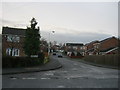
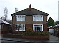
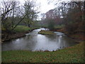
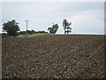
Photos of Whinfield Ward
Area Information
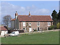
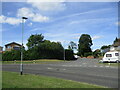
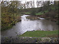
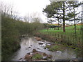
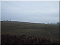
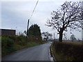
Living in Whinfield Ward offers a distinctly quiet experience within a compact setting. This district borough unitary ward covers just 1.1 square kilometres, meaning you will feel the boundaries of your neighbourhood quickly. The area does not sprawl, which can create a close-knit feel but also limits the choice of new developments. You should expect a very stable environment where daily life revolves around established patterns rather than rapid change. The minimisation of planning constraints means there are no protected woodlands, nature reserves, or Areas of Outstanding Natural Beauty interfering with local development potential. While this allows for flexibility in future housing projects, it also means any major changes are already part of the local consensus. Residents here deal with low flood risk and avoid the complexities of living near Ramsar sites. The ward operates as a functional part of the wider borough, detached from the bustle of larger city centres. Your days here will be routine and predictable, defined by a lack of major environmental hazards. This stability appeals to those who value simplicity over novelty in their residential options. If you are considering homes in Whinfield Ward, you are looking at a place where the extra mile of travel to amenities is a known quantity. The area's small size dictates that you must plan your daily trips carefully, as local services may be clustered in specific pockets. You will not find hidden surprises or shifting skylines here; everything is laid out plainly for you to assess. The absence of significant protected sites simplifies the planning landscape significantly for potential buyers. This lack of red tape can make transactions smoother compared to more restricted zones, though it rarely brings dramatic aesthetic changes to the streetscape. You are trading variety for certainty, a trade-off that defines the character of this ward.
- Area Type
- District Borough Unitary Ward
- Area Size
- 1.1 km²
- Population
- Not available
- Population Density
- Not available
Demographics
The community profile of Whinfield Ward is heavily weighted towards older residents. Data confirms that the median age sits at 70 years, indicating a retirement-focused population dominates the ward. This demographic skew suggests an atmosphere accustomed to slower paces and established routines rather than youthful energy or student clusters. When evaluating schools near Whinfield Ward, you would reasonably expect fewer children in the local vicinity, reflecting the high median age. The household composition aligns with this, as the most common age range recorded is listed simply as "Total," a statistical quirk that underscores the limited granularity regarding specific sub-groups in this dataset. Regardless of these reporting nuances, the overwhelming picture is one of ageing in place. Home ownership stands as a defining feature of this community. A staggering 73 percent of households own their homes outright or with a mortgage, which signals deep roots and financial security among residents. This high level of ownership contrasts sharply with typical rental-heavy estates or university quarters. Because so many people own their properties, decisions like moving or renovating often involve significant capital considerations rather than short-term renting. The predominance of owner-occupiers likely influences the character of the streets, fostering a sense of permanence. You will find fewer transient populations looking to flip houses or lease apartments briefly. The stability of this ownership model creates a reliable environment for long-term living. While the data does not specify ethnic breakdowns or religious affiliations individually, the homogeneity of age and ownership suggests a culturally consistent community. For those seeking a neighbourhood where neighbours have likely lived for decades, this data point on home ownership is reassuring.
Household Size
Accommodation Type
Tenure
Ethnic Group
Religion
Household Composition
Age
Household Deprivation
NS-SEC
Explore more demographic insights in this area
Go to Demographics tabPlanning
Planning Constraints
- Flood RiskPremium
- Ramsar Wetland SitesPremium
- Area of Outstanding Natural BeautyPremium
- Protected Nature ReservePremium
- Protected WoodlandPremium