Area Overview for Whalton
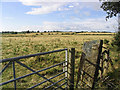
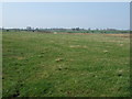
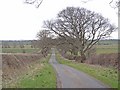
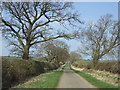
Photos of Whalton
Area Information
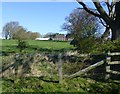
Living in Whalton offers a defined sense of place within a civil parish that spreads across 28.4 square kilometres. The location stands as a distinct pocket of England, providing enough space for residents to enjoy open land while maintaining access to established village life. You are not navigating a sprawling metropolis, but rather a settled area where daily routines involve familiar streets and known neighbours. The layout supports a quiet existence, ideal for those seeking a break from high-density urban environments. Your days will likely revolve around local amenities within easy reach, supported by a landscape that feels predominantly green and open. This setting provides a stable backdrop for family life and retirement, free from the acute noise often found in larger towns. The scale of the parish means that distance to the coast or nearby villages is manageable without the rush of highway travel. You will find a community that values local character over rapid change. Whether you view a house for sale or walk along the parish lane, the environment feels resilient and grounded. This is a place where life moves at a pace that allows you to notice the seasons changing around your garden.
- Area Type
- Parish
- Area Size
- 28.4 km²
- Population
- Not available
- Population Density
- Not available
Demographics
The community in Whalton is defined by a mature population, with the median age sitting at 70 years old. This statistic indicates that the area attracts a demographic focused on later life stages and retirement. You will encounter residents who have spent decades in the region, contributing to a long-standing local knowledge network. House ownership stands at 78 per cent, confirming that the vast majority of homes are owner-occupied rather than rented properties. This high level of ownership suggests financial stability among residents and places where people have dictated their living choices. Accommodation types reflect this ownership base, with single-family homes and semi-detached houses likely forming the bulk of the stock. The data does not specify individual ethnicity or religion breakdowns in the provided details, leaving the social fabric to be understood through the dominant lens of age and property tenure. Deprivation metrics are not explicitly quantified in the current dataset, but the high ownership rate often correlates with areas of moderate economic stability. You are likely dealing with neighbours who value permanence and are invested in the upkeep of their surroundings. This demographic profile supports local services tailored to older adults, from community groups to healthcare access.
Household Size
Accommodation Type
Tenure
Ethnic Group
Religion
Household Composition
Age
Household Deprivation
NS-SEC
Explore more demographic insights in this area
Go to Demographics tabPlanning
Planning Constraints
- Flood RiskLocked
- Ramsar Wetland SitesLocked
- Area of Outstanding Natural BeautyLocked
- Protected Nature ReserveLocked
- Protected WoodlandLocked
- Crime RiskLocked