Area Overview for West Rainton
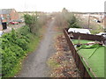
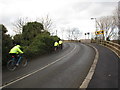
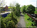
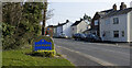
Photos of West Rainton
Area Information
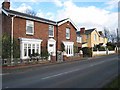
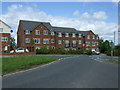
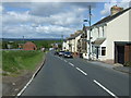
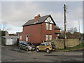
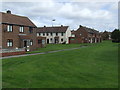
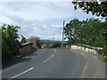
West Rainton is a compact built-up area in England, covering 71.2 hectares. Its population, while not explicitly stated, reflects a median age of 70, suggesting a community skewed towards older residents. This demographic shapes the area’s character, with a focus on stability and long-term residency. Daily life here is likely defined by a quieter, more established rhythm, with local amenities and transport links providing practical convenience. The proximity to rail stations such as Durham Railway Station and Bullion Lane, Chester, offers easy access to nearby towns, while nearby retail options like Sainsburys Durham and Spar Bells cater to everyday needs. For those considering living in West Rainton, the blend of practical infrastructure and a mature population makes it a viable choice for those seeking a settled, low-maintenance environment.
- Area Type
- Built Up Area 250
- Area Size
- 71.2 hectares
- Population
- Not available
- Population Density
- Not available
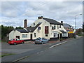
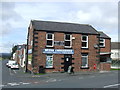
The lifestyle in West Rainton is shaped by its proximity to essential amenities. Retail options include Sainsburys Durham, Spar Bells, and Spar, offering a range of grocery and convenience services. The rail network, with stations like Durham Railway Station and Bullion Lane, Chester, provides access to broader transport routes. While the data does not specify parks or leisure facilities, the presence of nearby shops and train links suggests a practical, community-focused lifestyle. Residents can access daily essentials without significant travel, though the absence of detailed information on recreational spaces means the area’s leisure options remain partially unexplored.
Amenities
Schools
West Rainton Primary School is the only school explicitly listed in the data, offering education for younger children. It holds an Ofsted rating of ‘good’, indicating a satisfactory standard of teaching and facilities. The presence of a single primary school suggests that families with young children may need to look beyond the immediate area for secondary education options. The limited school data means the full range of educational provisions in West Rainton is not fully detailed, though the existing school provides a baseline for families prioritising primary education.
| Rank | School | Type | Entry gender | Ages |
|---|
Explore more schools in this area
Go to Schools tabDemographics
The population of West Rainton has a median age of 70, indicating a community predominantly composed of older residents. The most common age range is listed as ‘Age: Total’, which may suggest aggregated data rather than specific breakdowns. Home ownership stands at 61%, reflecting a mix of owner-occupied properties and rental stock. While the data does not specify household composition or accommodation types, the high median age may correlate with a higher proportion of single-person households or couples living together. The absence of detailed diversity metrics means the area’s ethnic and religious composition remains undefined in this dataset. For prospective buyers, the age profile implies a mature, stable population, though the lack of younger demographics could influence local services and social dynamics.
Household Size
Accommodation Type
Tenure
Ethnic Group
Religion
Household Composition
Age
Household Deprivation
NS-SEC
Explore more demographic insights in this area
Go to Demographics tabPlanning
Planning Constraints
- Crime RiskPremium