Area Overview for West Pelton
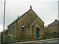
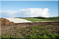
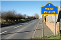
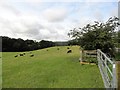
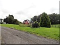
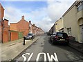
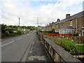
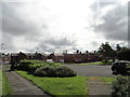
Photos of West Pelton
Area Information
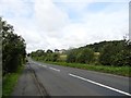
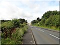
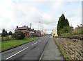
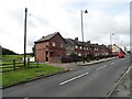
West Pelton is a built-up area in England covering 22.8 hectares, characterised by a mature population and a mix of residential properties. With a median age of 70, the area is predominantly inhabited by older residents, reflecting a community with a long-standing presence. Home ownership here is high, with 74% of properties owner-occupied, suggesting a stable and established demographic. The area’s compact size means amenities and services are within practical reach, though it lacks the sprawling infrastructure of larger towns. Daily life in West Pelton is shaped by its proximity to essential services, including retail outlets and rail connections. While the area does not have a distinct cultural or historical identity highlighted in the data, its straightforward layout and accessible amenities make it a pragmatic choice for those prioritising convenience over novelty. Prospective buyers should consider the age profile of the population, which may influence the character of local interactions and community dynamics.
- Area Type
- Built Up Area 250
- Area Size
- 22.8 hectares
- Population
- Not available
- Population Density
- Not available
West Pelton’s lifestyle is shaped by its accessible amenities, including five retail outlets such as Co-op Pelton, Morrisons Daily, and Budgens Shield. These shops provide essential services, from groceries to everyday goods, within walking or short driving distance. The rail connections at Station Road, Bullion Lane, and Chester enhance mobility, enabling residents to reach nearby towns or services. While the data does not mention parks or leisure facilities, the compact area size of 22.8 hectares may limit green spaces. Nonetheless, the proximity to retail and transport infrastructure ensures a practical, convenience-focused lifestyle. The absence of detailed information on leisure options means residents may need to explore beyond the immediate area for recreational activities.
Amenities
Schools
West Pelton Primary School is the only school listed in the data, serving the area’s primary education needs. It holds a “good” Ofsted rating, reflecting satisfactory standards in teaching and student outcomes. As a primary school, it caters to younger children, though the data does not mention secondary or other educational institutions. The presence of a single school suggests that families may need to travel to nearby areas for secondary education, though the rating indicates the primary school is a reliable foundation for early learning. The absence of additional schools limits the range of educational options, but the existing institution provides a baseline for families prioritising local schooling.
| Rank | School | Type | Entry gender | Ages |
|---|
Explore more schools in this area
Go to Schools tabDemographics
West Pelton’s population is defined by a median age of 70, with the most common age range encompassing all demographics. This suggests a community where older residents form a significant proportion, potentially impacting local services and social structures. Home ownership is high at 74%, indicating a largely settled population with long-term residency. The data does not specify household composition or accommodation types, but the overall figures suggest a stable, low-turnover environment. The absence of detailed diversity metrics means the area’s ethnic and religious composition remains unquantified, though the provided data does not indicate any specific challenges or advantages in this regard. For quality of life, the high home ownership rate may correlate with a sense of permanence, though the lack of detailed breakdowns on deprivation or household types limits deeper analysis.
Household Size
Accommodation Type
Tenure
Ethnic Group
Religion
Household Composition
Age
Household Deprivation
NS-SEC
Explore more demographic insights in this area
Go to Demographics tabPlanning
Planning Constraints
- Crime RiskPremium