Area Overview for Weetslade Ward
Photos of Weetslade Ward
Area Information
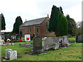
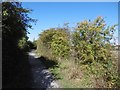
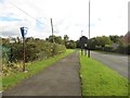
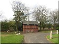
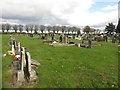
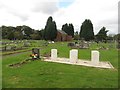
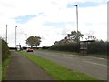
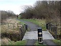
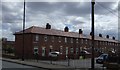
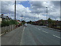
Living in Weetslade Ward offers a definitive North East experience within the Metropolitan Borough of North Tyneside. This electoral ward covers a compact footprint of 8.3 square kilometres, situated near Benton and Longbenton. The area is defined by its clear local government boundaries, which have been adjusted through historical orders like the 1992 Northumberland and Tyne and Wear boundaries. You will find specific landmarks that ground your daily life, including St John's United Reformed Church, St Columba's Church, and the John Willie Sams Centre. Local streets such as Elvet Cl, Aidan Cl, and Cranwel Cl provide the daily walking routes for residents. The geographical coordinates placing you around 55.052866, -1.612328 position you firmly in the region's established communities. Recent electoral changes continue to shape the administrative landscape of the ward. For those considering homes in Weetslade Ward, the setting combines traditional religious and community buildings with a defined residential footprint. This ward represents a settled part of North Tyneside where local services and neighbourhood boundaries are historically recognised and currently active.
- Area Type
- District Borough Unitary Ward
- Area Size
- 8.3 km²
- Population
- Not available
- Population Density
- Not available
Demographics
The community profile of Weetslade Ward is distinctly mature. People living in Weetslade Ward have a median age of 70 years, indicating a population dominated by older residents. The most common age range recorded for the total population reflects this significant demographic shift towards retirement years. Consequently, the daily atmosphere revolves around the needs and lifestyles of a senior demographic. Home ownership is high, with 74% of households owning their property outright or with a mortgage. This statistic confirms that the majority of residents are not tenants but owners invested in the local property pile. You are likely to see a high number of long-term occupants rather than transient families looking for temporary housing. The ward's household composition, accommodation types, and predominant religious and ethnic groups are recorded as total data points in the available dataset. This concentration of elderly homeowners suggests a stable, settled neighbourhood where families often downsize to larger properties suitable for retirement. Understanding this age profile is essential if you are considering homes in Weetslade Ward, as the social environment is catered primarily to an older demographic.
Household Size
Accommodation Type
Tenure
Ethnic Group
Religion
Household Composition
Age
Household Deprivation
NS-SEC
Explore more demographic insights in this area
Go to Demographics tabPlanning
Planning Constraints
- Flood RiskPremium
- Ramsar Wetland SitesPremium
- Area of Outstanding Natural BeautyPremium
- Protected Nature ReservePremium
- Protected WoodlandPremium
- Crime RiskPremium