Area Overview for Wallsend Central Ward
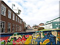
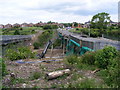
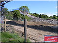
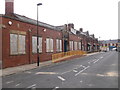
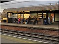
Photos of Wallsend Central Ward

Area Information
Living in Wallsend Central Ward offers a distinct residential experience centred around the historic town of Wallsend on the north bank of the River Tyne. This electoral ward constitutes a defined district within the Metropolitan Borough of North Tyneside, characterised by specific geographical boundaries and local governance. The area covers a total area size of 3.9 km², creating a relatively compact community where residents interact within a confined neighbourhood. A population of 3203 people resides across this zone, resulting in a density of 818 people per km². This concentration fosters an environment where services and amenities are likely within easy reach for daily needs. The ward is situated at approximately 54.9937°N, 1.5236°W, placing it firmly in the North East England landscape. You will find yourself part of a settled community with deep roots, where the physical scale of the ward dictates a very localised sense of place. Because the land area is small relative to the population density, life here feels immediate and interconnected. You do not traverse vast distances to engage with the core of the ward; everything happens within these 3.9 km². This structure supports a manageable pace of life despite the urban context of being across the river from Newcastle upon Tyne. The presence of the River Tyne defines the western edge of your daily horizons, while the ward boundaries enclose the majority of the residential fabric found in this section of North Tyneside.
- Area Type
- District Borough Unitary Ward
- Area Size
- 3.9 km²
- Population
- 3203
- Population Density
- 818 people/km²
Demographics
The community in Wallsend Central Ward presents a specific demographic profile that shapes the character of daily life. The median age is recorded at 70 years, indicating that the population skews significantly towards older residents. This age distribution suggests an area suitable for those seeking quieter living arrangements or later-life downsizing opportunities. At the time of data collection, the most common age range was noted simply as 'Age: Total', implying the dataset aggregates the entire population into this primary descriptor without breaking down younger cohorts in detail. Home ownership stands at 43%, meaning nearly half of the households live in rented accommodation or have not purchased their property outright. This figure indicates a balanced market where neither ownership nor renting overwhelmingly dominates the local housing stock. Household composition data is recorded generally under the category 'total', showing that makeup varies without a single predominant family type dictating the scene. Similarly, information regarding predominant ethnicity, religion, and specific accommodation types is aggregated under a 'total' classification. This lack of granular breakdown means you cannot identify a specific cultural demographic or housing style as the sole norm. However, the ownership percentage remains a clear, actionable fact for potential buyers. With 43% of locals owning their homes, there is a substantial existing base of owner-occupiers contributing to the community stability. The high median age combined with moderate ownership levels creates a static, perhaps inherited, social structure rather than a rapidly changing demographic landscape.
Household Size
Accommodation Type
Tenure
Ethnic Group
Religion
Household Composition
Age
Household Deprivation
NS-SEC
Explore more demographic insights in this area
Go to Demographics tabPlanning
Planning Constraints
- Flood RiskPremium
- Ramsar Wetland SitesPremium
- Area of Outstanding Natural BeautyPremium
- Protected Nature ReservePremium
- Protected WoodlandPremium
- Crime RiskPremium