Area Overview for Wallington Demesne
Photos of Wallington Demesne

Area Information
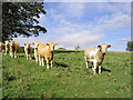
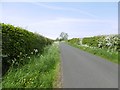
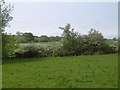
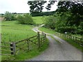
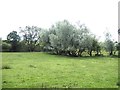
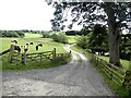
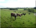
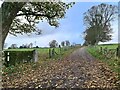
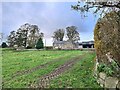
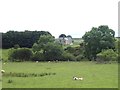
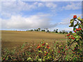
Wallington Demesne is a civil parish spanning 28.4 km² in Surrey, offering a distinct setting for those seeking space away from the immediate metro fringe. The area operates as a self-contained community where residents enjoy low flood risk and no designation within protected nature reserves or Areas of Outstanding Natural Beauty. You will find the parish comprises diverse housing, yet the environment remains peaceful with notable protected woodland areas that contribute to the local landscape. Living in Wallington Demesne means navigating a landscape defined by its rural character and specific planning constraints, particularly regarding the preserved woodlands that limit development potential in certain pockets. The land covers a substantial footprint, ensuring that newer builds do not crowd existing properties. This isolation can be a benefit for families wanting quiet surroundings or a drawback for those seeking proximity to major employment hubs. Your daily life here revolves around the community centre at its core, offering a sense of rootedness that larger towns lack. The defined boundaries of the parish create a clear identity, separating it from neighbouring settlements while maintaining its own administrative status. Prospective buyers must weigh the spaciousness of the land against the potential distance from high-frequency public transport links. Understanding the local geography helps clarify what life actually entails for you in this specific location.
- Area Type
- Parish
- Area Size
- 28.4 km²
- Population
- Not available
- Population Density
- Not available
Demographics
The community profile of Wallington Demesne reflects a settled demographic with a median age of 70 years. This high average indicates that the population consists largely of retirees and older residents rather than young families or working-age professionals. You are looking at an area where life often slows down, catering to those who have retired to the countryside. The total household composition supports this senior-led dynamic, suggesting fewer large households with young children and more single-person or couple-only homes. Home ownership stands at 57%, a significant portion of residents owning their property outright or with a mortgage. This suggests stability within the community and fewer tenant turnover issues common in younger urban areas. The data shows no breakdown for predominant ethnic groups or religious affiliations, focusing solely on the age and ownership metrics available. For you, this means a neighbourly environment where generations likely know one another. The lack of typical demographic markers often points to a homogeneous group united by lifestyle choices rather than economic necessity. Living in Wallington Demesne is ideal for those entering retirement or those building a nest egg well before that age. The area does not cater to the needs of a workforce-commuting populace, further reinforcing its status as a retirement-focused parish. You may find the pace of life matches your own if you enjoy the quieter rhythms of a mature community.
Household Size
Accommodation Type
Tenure
Ethnic Group
Religion
Household Composition
Age
Household Deprivation
NS-SEC
Explore more demographic insights in this area
Go to Demographics tabPlanning
Planning Constraints
- Flood RiskPremium
- Ramsar Wetland SitesPremium
- Area of Outstanding Natural BeautyPremium
- Protected Nature ReservePremium
- Protected WoodlandPremium
- Crime RiskPremium