Area Overview for Dinnington (Newcastle upon Tyne)
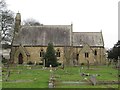
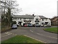
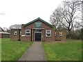
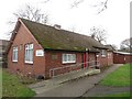
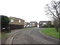
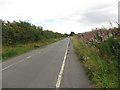
Photos of Dinnington (Newcastle upon Tyne)


Area Information
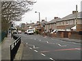
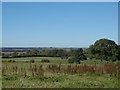
Living in Dinnington (Newcastle upon Tyne) offers a compact, well-connected environment within a 60.5-hectare built-up area. The community is characterised by a median age of 70, suggesting a population skewed toward older residents. Despite its size, the area is strategically positioned near key transport hubs, including Newcastle Airport and multiple rail and metro stations, such as Newcastle Airport Metro Station and Cramlington Railway Station. This connectivity makes it practical for commuters and those reliant on public transport. The presence of Dinnington First School, rated good by Ofsted, adds to the appeal for families. Daily life here is shaped by proximity to retail outlets like Morrisons and Spar, as well as the convenience of high-speed broadband, rated at 100 out of 100. While the area may not cater to younger demographics, its infrastructure and safety profile—marked by a crime risk score of 77—make it a viable option for those seeking a stable, low-risk neighbourhood.
- Area Type
- Built Up Area 250
- Area Size
- 60.5 hectares
- Population
- Not available
- Population Density
- Not available
Residents of Dinnington (Newcastle upon Tyne) have access to a range of amenities within practical reach. Retail options include M&S Newcastle Air SF, Morrisons, and Spar, providing everyday shopping convenience. The proximity to Newcastle Airport offers easy travel for both leisure and business. Transport links such as the Newcastle Airport Metro Station, Cramlington Railway Station, and several metro stops like Bank Foot and Kingston Park enhance mobility. While the area lacks detailed information on parks or leisure facilities, the availability of multiple retail and transport points suggests a lifestyle focused on practicality and accessibility. The combination of shops, transport hubs, and the airport caters to both daily needs and broader travel requirements, supporting a functional, connected community.
Amenities
Schools
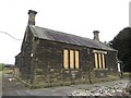
The primary school nearest to Dinnington (Newcastle upon Tyne) is Dinnington First School, which holds a good Ofsted rating. This school serves the local community, providing education for younger residents. The absence of secondary schools in the data means families with older children may need to look beyond the immediate area for further education. The presence of a rated primary school is a key factor for families prioritising school quality, though the lack of additional educational institutions could be a consideration for those requiring a broader range of options. The single listed school reflects the area’s focus on primary education, aligning with the demographic profile of an older population.
| Rank | School | Type | Entry gender | Ages |
|---|
Explore more schools in this area
Go to Schools tabDemographics
Dinnington (Newcastle upon Tyne) has a median age of 70, with the most common age range encompassing the total population. Home ownership is high at 73%, indicating a community where many residents are long-term occupants rather than renters. The data does not specify household composition or accommodation types, but the overall demographic suggests a mature population with established living patterns. The predominant ethnic group and religious affiliation are not detailed, so assumptions about diversity cannot be made. The absence of specific figures on deprivation means the area’s quality of life remains unquantified in this context. For buyers, the high home ownership rate implies a stable housing market, though the age profile may influence local services and amenities tailored to older residents.
Household Size
Accommodation Type
Tenure
Ethnic Group
Religion
Household Composition
Age
Household Deprivation
NS-SEC
Explore more demographic insights in this area
Go to Demographics tabPlanning
Planning Constraints
- Crime RiskPremium