Area Overview for Gateshead
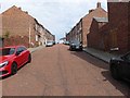
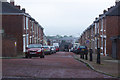
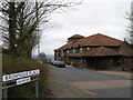
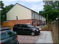
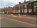
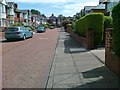
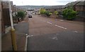
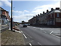
Photos of Gateshead
Area Information
Living in Gateshead offers a compact yet dynamic urban experience within a 28.7 km² area. With a population of 48,700, the borough has a population density of 1,697 people per square kilometre, reflecting a tightly knit community. As a built-up area in northeast England, Gateshead balances urban convenience with proximity to natural landscapes. The median age of 70 suggests a mature demographic, though this figure may reflect data categorisation rather than a homogeneous age profile. Daily life is shaped by its infrastructure, including five rail stations and multiple retail outlets, ensuring accessibility to services. The area’s appeal lies in its practicality—residents benefit from a mix of local amenities, including schools, transport hubs, and leisure facilities. While the population density is high, the area’s compact size means essential services are within walking or short driving distance. For those prioritising connectivity and community, Gateshead provides a foundation of stability, though its character is defined as much by its challenges as its conveniences.
- Area Type
- Built Up Area 250
- Area Size
- 28.7 km²
- Population
- 48700
- Population Density
- 1697 people/km²
Gateshead’s lifestyle is shaped by its proximity to a range of amenities. Retail options include Spar, Heron Durham, and Tesco Gateshead Carr, offering everyday shopping needs. The metro and rail networks provide access to leisure spots such as Gateshead Stadium, while rail stations like Heworth and Manors connect to further destinations. A single bus stop at Rhodes Street adds local transport flexibility. Though parks and recreational spaces are not explicitly listed in the data, the area’s compact size suggests that green spaces are likely accessible within short distances. The presence of multiple schools and transport hubs indicates a community-oriented environment, where daily life is centred around local services. While specific leisure venues are not detailed, the combination of retail, transport, and education infrastructure implies a functional, if modest, lifestyle.
Amenities
Schools
Gateshead’s schools cater to a range of educational needs, with a focus on primary and nursery education. Bensham Grove Nursery School provides early years education, while Carr Hill Community Primary School and Kelvin Grove Community Primary School both hold "Good" Ofsted ratings, indicating reliable standards. Harlow Green Junior School and Low Fell County Junior School serve younger primary students, though their Ofsted ratings are not specified. The presence of multiple primary schools suggests a strong local education infrastructure, particularly for families with young children. However, the absence of secondary schools in the data means older students may need to travel beyond the immediate area. The mix of nursery and primary schools supports a continuum of education, but families requiring secondary schooling should consider proximity to larger educational hubs.
| Rank | School | Type | Entry gender | Ages |
|---|
Explore more schools in this area
Go to Schools tabDemographics
Gateshead’s demographic profile is defined by a median age of 70, which is notably higher than the national average. This suggests a community skewed towards older residents, though the "Total" designation for the most common age range indicates data limitations in specifying subgroups. Home ownership stands at 54%, meaning nearly half of residents own their homes, while the remaining 46% may be in rental or other tenures. Accommodation types and household compositions are not detailed in the data, but the high home ownership rate implies a stable residential base. The predominant ethnic group and religion categories are also listed as "Total," offering no breakdown of diversity. This lack of granularity may affect understanding of cultural or social dynamics. However, the 54% home ownership rate suggests a community with established roots, though the absence of specific data on deprivation or household types means broader quality-of-life implications remain unclear.