Area Overview for TS8 0SQ
Photos of TS8 0SQ
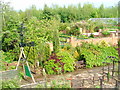
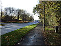
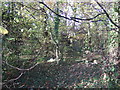
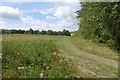
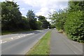
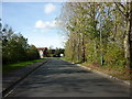

8 photos from this area
Area Information
Key information about the TS8 0SQ including its size, population, and administrative classification.
- Area Type
- Postcode
- Area Size
- 1.7 hectares
- Population
- 1463
- Population Density
- 2174 people/km²
House Prices in TS8 0SQ
42
Properties
£100,935
Average Sold Price
£28,000
Lowest Price
£195,000
Highest Price
Showing 42 properties
| Address | Type | Beds | Baths | Last Sale Price | Last Sale Date | |
|---|---|---|---|---|---|---|
| 33 The Holt, Middlesbrough, TS8 0SQ | Semi-detached | 2 | 1 | £110,000 | Feb 2025 | |
| 6 The Holt, Middlesbrough, TS8 0SQ | house | 2 | 1 | £115,000 | Mar 2024 | |
| 4 The Holt, Middlesbrough, TS8 0SQ | house | - | - | £128,500 | Mar 2023 | |
| 32 The Holt, Middlesbrough, TS8 0SQ | house | - | - | £159,950 | Jul 2022 | |
| 23 The Holt, Middlesbrough, TS8 0SQ | house | - | - | £177,000 | Jul 2022 | |
| 34 The Holt, Middlesbrough, TS8 0SQ | Semi-detached | 2 | 1 | £128,000 | May 2022 | |
| 19 The Holt, Middlesbrough, TS8 0SQ | house | - | - | £152,000 | Jan 2022 | |
| 7 The Holt, Middlesbrough, TS8 0SQ | house | 5 | 1 | £195,000 | Dec 2021 | |
| 5 The Holt, Middlesbrough, TS8 0SQ | house | - | - | £125,000 | Mar 2021 | |
| 12 The Holt, Middlesbrough, TS8 0SQ | Semi-detached | - | - | £82,000 | Jan 2021 |
Page 1 of 5
Energy Efficiency in TS8 0SQ
Amenities
Schools
| Rank | School | Type | Entry gender | Ages |
|---|
Explore more schools in this area
Go to Schools tabDemographics
Household Size
One person
most common
Accommodation Type
Houses
most common
Tenure
47
majority
Ethnic Group
White
most common
Religion
N/A
most common
Household Composition
N/A
most common
Age
47
median
Adults (30-64 years)
most common
Household Deprivation
N/A
with no deprivation
NS-SEC
20
in Lower managerial occupations
Explore more demographic insights in this area
Go to Demographics tabPlanning
Planning Constraints
- Flood RiskPremium
- Ramsar Wetland SitesPremium
- Area of Outstanding Natural BeautyPremium
- Protected Nature ReservePremium
- Protected WoodlandPremium