Area Overview for TS8 0RU
Photos of TS8 0RU
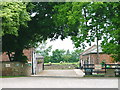
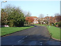
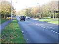
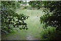
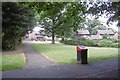
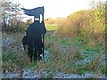
6 photos from this area
Area Information
Key information about the TS8 0RU including its size, population, and administrative classification.
- Area Type
- Postcode
- Area Size
- 3.2 hectares
- Population
- 1199
- Population Density
- 2645 people/km²
House Prices in TS8 0RU
66
Properties
£165,686
Average Sold Price
£55,000
Lowest Price
£1,695,000
Highest Price
Showing 66 properties
| Address | Type | Beds | Baths | Last Sale Price | Last Sale Date | |
|---|---|---|---|---|---|---|
| 29 Fox Howe, Middlesbrough, TS8 0RU | Detached | 3 | 1 | £172,500 | Dec 2025 | |
| 38 Fox Howe, Middlesbrough, TS8 0RU | Semi-detached | 2 | 1 | £145,000 | Dec 2024 | |
| 4 Fox Howe, Middlesbrough, TS8 0RU | Terraced | 2 | - | £147,000 | Sep 2024 | |
| 38A Fox Howe, Middlesbrough, TS8 0RU | Semi-detached | 2 | 1 | £135,000 | Mar 2024 | |
| 54 Fox Howe, Middlesbrough, TS8 0RU | Bungalow | 2 | 1 | £135,000 | Jun 2023 | |
| 2 Fox Howe, Middlesbrough, TS8 0RU | Terraced | 2 | - | £126,000 | Nov 2022 | |
| 26 Fox Howe, Middlesbrough, TS8 0RU | house | 2 | 1 | £1,695,000 | Jun 2022 | |
| 43 Fox Howe, Middlesbrough, TS8 0RU | Detached | 4 | 2 | £210,000 | Dec 2021 | |
| 21 Fox Howe, Middlesbrough, TS8 0RU | house | - | - | £200,000 | Sep 2021 | |
| 55 Fox Howe, Middlesbrough, TS8 0RU | Bungalow | - | - | £130,000 | Mar 2021 |
Page 1 of 7
Energy Efficiency in TS8 0RU
Amenities
Schools
| Rank | School | Type | Entry gender | Ages |
|---|
Explore more schools in this area
Go to Schools tabDemographics
Household Size
One person
most common
Accommodation Type
Houses
most common
Tenure
49
majority
Ethnic Group
White
most common
Religion
N/A
most common
Household Composition
N/A
most common
Age
47
median
Adults (30-64 years)
most common
Household Deprivation
N/A
with no deprivation
NS-SEC
20
in Lower managerial occupations
Explore more demographic insights in this area
Go to Demographics tabPlanning
Planning Constraints
- Flood RiskPremium
- Ramsar Wetland SitesPremium
- Area of Outstanding Natural BeautyPremium
- Protected Nature ReservePremium
- Protected WoodlandPremium