Area Overview for TS7 9PB
Photos of TS7 9PB


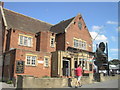
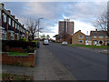
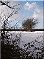
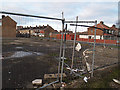
14 photos from this area
Area Information
Key information about the TS7 9PB including its size, population, and administrative classification.
- Area Type
- Postcode
- Area Size
- 7661 m²
- Population
- 1502
- Population Density
- 4213 people/km²
House Prices in TS7 9PB
17
Properties
£101,581
Average Sold Price
£27,500
Lowest Price
£232,000
Highest Price
Showing 17 properties
| Address | Type | Beds | Baths | Last Sale Price | Last Sale Date | |
|---|---|---|---|---|---|---|
| 59 High Street, Middlesbrough, TS7 9PB | Bungalow | 1 | 1 | £124,500 | Dec 2024 | |
| 57 High Street, Middlesbrough, TS7 9PB | Bungalow | - | - | £93,500 | Jan 2019 | |
| 45 High Street, Middlesbrough, TS7 9PB | Terraced | - | - | £232,000 | Dec 2008 | |
| 47 High Street, Middlesbrough, TS7 9PB | Terraced | - | - | £118,500 | Aug 2007 | |
| 53A High Street, Middlesbrough, TS7 9PB | Bungalow | 3 | 1 | £110,000 | Mar 2007 | |
| 49 High Street, Middlesbrough, TS7 9PB | Bungalow | 1 | 1 | £38,150 | Aug 2002 | |
| 55 High Street, Middlesbrough, TS7 9PB | Terraced | - | - | £68,500 | May 1996 | |
| 51 High Street, Middlesbrough, TS7 9PB | Terraced | - | - | £27,500 | Apr 1995 | |
| 61 High Street, Middlesbrough, TS7 9PB | Cottage | 1 | 1 | - | - | |
| 63 High Street, Middlesbrough, TS7 9PB | Detached | - | - | - | - |
Page 1 of 2
Energy Efficiency in TS7 9PB
Amenities
Schools
| Rank | School | Type | Entry gender | Ages |
|---|
Explore more schools in this area
Go to Schools tabDemographics
Household Size
Two person
most common
Accommodation Type
Houses
most common
Tenure
67
majority
Ethnic Group
White
most common
Religion
N/A
most common
Household Composition
N/A
most common
Age
47
median
Adults (30-64 years)
most common
Household Deprivation
N/A
with no deprivation
NS-SEC
17
in Lower managerial occupations
Explore more demographic insights in this area
Go to Demographics tabPlanning
Planning Constraints
- Flood RiskPremium
- Ramsar Wetland SitesPremium
- Area of Outstanding Natural BeautyPremium
- Protected Nature ReservePremium
- Protected WoodlandPremium