Area Overview for TS7 9LB
Photos of TS7 9LB
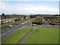
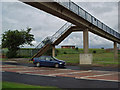
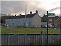

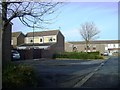
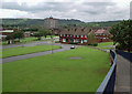
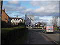
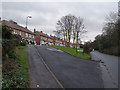
15 photos from this area
Area Information
Key information about the TS7 9LB including its size, population, and administrative classification.
- Area Type
- Postcode
- Area Size
- 5513 m²
- Population
- 1570
- Population Density
- 3071 people/km²
House Prices in TS7 9LB
24
Properties
£75,687
Average Sold Price
£60,000
Lowest Price
£93,000
Highest Price
Showing 24 properties
| Address | Type | Beds | Baths | Last Sale Price | Last Sale Date | |
|---|---|---|---|---|---|---|
| 36 Wetherby Green, Ormesby, TS7 9LB | Terraced | 3 | 1 | £80,000 | May 2025 | |
| 12 Wetherby Green, Ormesby, TS7 9LB | Terraced | 3 | 1 | £93,000 | Mar 2025 | |
| 38 Wetherby Green, Ormesby, TS7 9LB | house | 3 | - | £82,000 | Jul 2022 | |
| 28 Wetherby Green, Ormesby, TS7 9LB | Terraced | 3 | 1 | £82,500 | Jun 2022 | |
| 32 Wetherby Green, Ormesby, TS7 9LB | house | 3 | 1 | £70,000 | Jul 2021 | |
| 20 Wetherby Green, Ormesby, TS7 9LB | Terraced | 3 | - | £74,995 | Nov 2020 | |
| 24 Wetherby Green, Ormesby, TS7 9LB | Terraced | 3 | 1 | £63,000 | Apr 2012 | |
| 1 Wetherby Green, Ormesby, TS7 9LB | house | 3 | - | £60,000 | Aug 2005 | |
| 11 Wetherby Green, Ormesby, TS7 9LB | Flat | - | - | - | - | |
| 3 Wetherby Green, Ormesby, TS7 9LB | house | - | - | - | - |
Page 1 of 3
Energy Efficiency in TS7 9LB
Amenities
Schools
| Rank | School | Type | Entry gender | Ages |
|---|
Explore more schools in this area
Go to Schools tabDemographics
Household Size
One person
most common
Accommodation Type
Houses
most common
Tenure
39
majority
Ethnic Group
White
most common
Religion
N/A
most common
Household Composition
N/A
most common
Age
47
median
Adults (30-64 years)
most common
Household Deprivation
N/A
with no deprivation
NS-SEC
13
in Lower managerial occupations
Explore more demographic insights in this area
Go to Demographics tabPlanning
Planning Constraints
- Flood RiskPremium
- Ramsar Wetland SitesPremium
- Area of Outstanding Natural BeautyPremium
- Protected Nature ReservePremium
- Protected WoodlandPremium