Area Overview for TS7 9HW
Photos of TS7 9HW
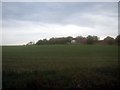
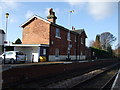
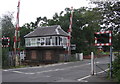
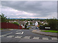
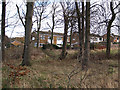
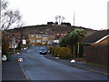
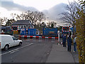
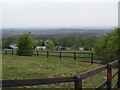
21 photos from this area
Area Information
Key information about the TS7 9HW including its size, population, and administrative classification.
- Area Type
- Postcode
- Area Size
- 2.9 hectares
- Population
- 1770
- Population Density
- 1900 people/km²
House Prices in TS7 9HW
16
Properties
£130,991
Average Sold Price
£59,950
Lowest Price
£165,000
Highest Price
Showing 16 properties
| Address | Type | Beds | Baths | Last Sale Price | Last Sale Date | |
|---|---|---|---|---|---|---|
| 68 Woodley Grove, Ormesby, TS7 9HW | Detached | 2 | 1 | £126,000 | Aug 2025 | |
| 66 Woodley Grove, Ormesby, TS7 9HW | Semi-detached | 2 | - | £145,000 | Sep 2024 | |
| 62 Woodley Grove, Ormesby, TS7 9HW | house | - | - | £138,000 | Oct 2022 | |
| 64 Woodley Grove, Ormesby, TS7 9HW | Bungalow | 2 | 1 | £123,000 | Jul 2022 | |
| 78 Woodley Grove, Ormesby, TS7 9HW | Bungalow | - | - | £160,000 | Aug 2021 | |
| 61 Woodley Grove, Ormesby, TS7 9HW | Bungalow | - | - | £129,950 | Dec 2015 | |
| 72 Woodley Grove, Ormesby, TS7 9HW | Semi-detached | 5 | - | £165,000 | Dec 2014 | |
| 60 Woodley Grove, Ormesby, TS7 9HW | Semi-detached | - | - | £125,000 | Oct 2012 | |
| 70 Woodley Grove, Ormesby, TS7 9HW | Bungalow | 2 | - | £124,995 | Sep 2012 | |
| 74 Woodley Grove, Ormesby, TS7 9HW | Bungalow | - | - | £138,000 | Dec 2006 |
Page 1 of 2
Energy Efficiency in TS7 9HW
Amenities
Schools
| Rank | School | Type | Entry gender | Ages |
|---|
Explore more schools in this area
Go to Schools tabDemographics
Household Size
Two person
most common
Accommodation Type
Houses
most common
Tenure
91
majority
Ethnic Group
White
most common
Religion
N/A
most common
Household Composition
N/A
most common
Age
47
median
Adults (30-64 years)
most common
Household Deprivation
N/A
with no deprivation
NS-SEC
33
in Lower managerial occupations
Explore more demographic insights in this area
Go to Demographics tabPlanning
Planning Constraints
- Flood RiskPremium
- Ramsar Wetland SitesPremium
- Area of Outstanding Natural BeautyPremium
- Protected Nature ReservePremium
- Protected WoodlandPremium