Area Overview for TS7 0LF
Photos of TS7 0LF
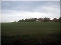
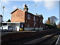
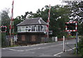
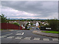
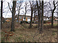
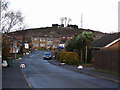
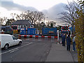
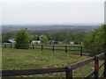
21 photos from this area
Area Information
Key information about the TS7 0LF including its size, population, and administrative classification.
- Area Type
- Postcode
- Area Size
- 4.3 hectares
- Population
- 1770
- Population Density
- 1900 people/km²
House Prices in TS7 0LF
24
Properties
£202,309
Average Sold Price
£125,000
Lowest Price
£342,500
Highest Price
Showing 24 properties
| Address | Type | Beds | Baths | Last Sale Price | Last Sale Date | |
|---|---|---|---|---|---|---|
| 37 Rothesay Grove, Nunthorpe, TS7 0LF | Bungalow | 2 | 1 | £205,000 | Mar 2025 | |
| 51 Rothesay Grove, Nunthorpe, TS7 0LF | Bungalow | 5 | 1 | £342,500 | Mar 2024 | |
| 5 Rothesay Grove, Nunthorpe, TS7 0LF | Bungalow | 2 | 1 | £185,000 | Nov 2023 | |
| 49 Rothesay Grove, Nunthorpe, TS7 0LF | house | - | - | £221,250 | Aug 2022 | |
| 35 Rothesay Grove, Nunthorpe, TS7 0LF | Bungalow | 4 | 1 | £265,000 | Jan 2022 | |
| 11 Rothesay Grove, Nunthorpe, TS7 0LF | Bungalow | 2 | 1 | £249,000 | Sep 2021 | |
| 19 Rothesay Grove, Nunthorpe, TS7 0LF | Bungalow | 4 | - | £220,000 | Oct 2019 | |
| 45 Rothesay Grove, Nunthorpe, TS7 0LF | Bungalow | 3 | 2 | £225,000 | Sep 2017 | |
| 21 Rothesay Grove, Nunthorpe, TS7 0LF | Bungalow | 2 | - | £170,000 | Jun 2015 | |
| 31 Rothesay Grove, Nunthorpe, TS7 0LF | Bungalow | - | - | £202,500 | Sep 2014 |
Page 1 of 3
Energy Efficiency in TS7 0LF
Amenities
Schools
| Rank | School | Type | Entry gender | Ages |
|---|
Explore more schools in this area
Go to Schools tabDemographics
Household Size
Two person
most common
Accommodation Type
Houses
most common
Tenure
91
majority
Ethnic Group
White
most common
Religion
N/A
most common
Household Composition
N/A
most common
Age
47
median
Adults (30-64 years)
most common
Household Deprivation
N/A
with no deprivation
NS-SEC
33
in Lower managerial occupations
Explore more demographic insights in this area
Go to Demographics tabPlanning
Planning Constraints
- Flood RiskPremium
- Ramsar Wetland SitesPremium
- Area of Outstanding Natural BeautyPremium
- Protected Nature ReservePremium
- Protected WoodlandPremium