Area Overview for TS7 0GB
Photos of TS7 0GB

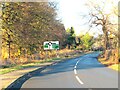
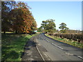
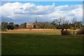
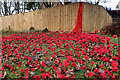
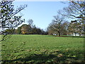
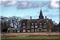
7 photos from this area
Area Information
Key information about the TS7 0GB including its size, population, and administrative classification.
- Area Type
- Postcode
- Area Size
- 13.7 hectares
- Population
- 2563
- Population Density
- 450 people/km²
House Prices in TS7 0GB
40
Properties
£546,950
Average Sold Price
£385,000
Lowest Price
£810,000
Highest Price
Showing 40 properties
| Address | Type | Beds | Baths | Last Sale Price | Last Sale Date | |
|---|---|---|---|---|---|---|
| 3 Collingham Drive, Middlesbrough, TS7 0GB | house | - | - | £595,000 | Mar 2025 | |
| 21 Collingham Drive, Middlesbrough, TS7 0GB | house | 6 | 4 | £795,000 | Aug 2024 | |
| 33 Collingham Drive, Middlesbrough, TS7 0GB | house | - | - | £660,000 | Sep 2023 | |
| 1 Collingham Drive, Middlesbrough, TS7 0GB | house | - | - | £600,000 | Apr 2023 | |
| 38 Collingham Drive, Middlesbrough, TS7 0GB | Detached | 5 | 3 | £450,000 | Feb 2022 | |
| 39 Collingham Drive, Middlesbrough, TS7 0GB | house | - | - | £535,000 | Mar 2021 | |
| 15 Collingham Drive, Middlesbrough, TS7 0GB | Detached | 6 | - | £810,000 | Nov 2020 | |
| 2 Collingham Drive, Middlesbrough, TS7 0GB | Detached | 5 | - | £535,000 | Sep 2019 | |
| 11 Collingham Drive, Middlesbrough, TS7 0GB | Detached | 6 | 5 | £660,000 | Feb 2018 | |
| 26 Collingham Drive, Middlesbrough, TS7 0GB | Detached | 4 | - | £475,000 | Jan 2018 |
Page 1 of 4
Energy Efficiency in TS7 0GB
Amenities
Schools
| Rank | School | Type | Entry gender | Ages |
|---|
Explore more schools in this area
Go to Schools tabDemographics
Household Size
Family (3-5 people)
most common
Accommodation Type
Houses
most common
Tenure
92
majority
Ethnic Group
White
most common
Religion
N/A
most common
Household Composition
N/A
most common
Age
47
median
Adults (30-64 years)
most common
Household Deprivation
N/A
with no deprivation
NS-SEC
47
in Lower managerial occupations
Explore more demographic insights in this area
Go to Demographics tabPlanning
Planning Constraints
- Flood RiskPremium
- Ramsar Wetland SitesPremium
- Area of Outstanding Natural BeautyPremium
- Protected Nature ReservePremium
- Protected WoodlandPremium