Area Overview for TS6 9LA
Photos of TS6 9LA
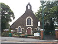
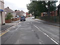
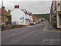
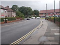
32 photos from this area
Area Information
Key information about the TS6 9LA including its size, population, and administrative classification.
- Area Type
- Postcode
- Area Size
- 1.5 hectares
- Population
- 1287
- Population Density
- 5221 people/km²
House Prices in TS6 9LA
61
Properties
£69,202
Average Sold Price
£14,250
Lowest Price
£119,950
Highest Price
Showing 61 properties
| Address | Type | Beds | Baths | Last Sale Price | Last Sale Date | |
|---|---|---|---|---|---|---|
| 64 Guisborough Street, Eston, TS6 9LA | Flat | 1 | 1 | £55,000 | Feb 2025 | |
| 78 Guisborough Street, Eston, TS6 9LA | Semi-detached | 2 | 1 | £110,000 | May 2024 | |
| 60 Guisborough Street, Eston, TS6 9LA | Flat | 1 | - | £50,000 | Sep 2023 | |
| 2 Guisborough Street, Eston, TS6 9LA | house | 1 | 1 | £62,000 | May 2022 | |
| 14 Guisborough Street, Eston, TS6 9LA | house | - | - | £105,000 | Feb 2022 | |
| 18 Guisborough Street, Eston, TS6 9LA | house | - | - | £85,500 | Dec 2021 | |
| 62 Guisborough Street, Eston, TS6 9LA | Flat | - | - | £55,000 | Nov 2021 | |
| 51 Guisborough Street, Eston, TS6 9LA | house | - | - | £78,000 | Nov 2021 | |
| 74 Guisborough Street, Eston, TS6 9LA | house | - | - | £118,000 | Dec 2020 | |
| 56 Guisborough Street, Eston, TS6 9LA | Semi-detached | 2 | 1 | £90,000 | Dec 2018 |
Page 1 of 7
Energy Efficiency in TS6 9LA
Amenities
Schools
| Rank | School | Type | Entry gender | Ages |
|---|
Explore more schools in this area
Go to Schools tabDemographics
Household Size
One person
most common
Accommodation Type
Houses
most common
Tenure
42
majority
Ethnic Group
White
most common
Religion
N/A
most common
Household Composition
N/A
most common
Age
47
median
Adults (30-64 years)
most common
Household Deprivation
N/A
with no deprivation
NS-SEC
16
in Lower managerial occupations
Explore more demographic insights in this area
Go to Demographics tabPlanning
Planning Constraints
- Flood RiskPremium
- Ramsar Wetland SitesPremium
- Area of Outstanding Natural BeautyPremium
- Protected Nature ReservePremium
- Protected WoodlandPremium