Area Overview for TS6 0PH
Photos of TS6 0PH
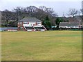

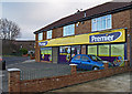
3 photos from this area
Area Information
Key information about the TS6 0PH including its size, population, and administrative classification.
- Area Type
- Postcode
- Area Size
- 1.1 hectares
- Population
- 1145
- Population Density
- 2614 people/km²
House Prices in TS6 0PH
18
Properties
£132,767
Average Sold Price
£60,000
Lowest Price
£212,000
Highest Price
Showing 18 properties
| Address | Type | Beds | Baths | Last Sale Price | Last Sale Date | |
|---|---|---|---|---|---|---|
| 12 Firtree Avenue, Normanby, TS6 0PH | Semi-detached | 3 | 1 | £212,000 | Oct 2022 | |
| 30 Firtree Avenue, Normanby, TS6 0PH | Detached | 3 | 1 | £205,000 | Dec 2017 | |
| 6 Firtree Avenue, Normanby, TS6 0PH | Bungalow | 2 | - | £142,500 | Dec 2016 | |
| 22 Firtree Avenue, Normanby, TS6 0PH | Bungalow | 3 | - | £195,000 | Sep 2012 | |
| 18 Firtree Avenue, Normanby, TS6 0PH | house | 3 | - | £165,500 | Mar 2011 | |
| 26 Firtree Avenue, Normanby, TS6 0PH | Semi-detached | 3 | 1 | £66,950 | Feb 1999 | |
| 28 Firtree Avenue, Normanby, TS6 0PH | Semi-detached | 3 | 1 | £69,950 | May 1998 | |
| 24 Firtree Avenue, Normanby, TS6 0PH | Detached | - | - | £78,000 | Oct 1997 | |
| 10 Firtree Avenue, Normanby, TS6 0PH | Semi-detached | - | - | £60,000 | May 1995 | |
| 2 Firtree Avenue, Normanby, TS6 0PH | Bungalow | 3 | 2 | - | - |
Page 1 of 2
Energy Efficiency in TS6 0PH
Amenities
Schools
| Rank | School | Type | Entry gender | Ages |
|---|
Explore more schools in this area
Go to Schools tabDemographics
Household Size
Two person
most common
Accommodation Type
Houses
most common
Tenure
91
majority
Ethnic Group
White
most common
Religion
N/A
most common
Household Composition
N/A
most common
Age
47
median
Adults (30-64 years)
most common
Household Deprivation
N/A
with no deprivation
NS-SEC
31
in Lower managerial occupations
Explore more demographic insights in this area
Go to Demographics tabPlanning
Planning Constraints
- Flood RiskPremium
- Ramsar Wetland SitesPremium
- Area of Outstanding Natural BeautyPremium
- Protected Nature ReservePremium
- Protected WoodlandPremium