Area Overview for TS4 3RF
Photos of TS4 3RF


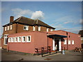
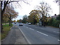
4 photos from this area
Area Information
Key information about the TS4 3RF including its size, population, and administrative classification.
- Area Type
- Postcode
- Area Size
- 1.3 hectares
- Population
- 1253
- Population Density
- 6693 people/km²
House Prices in TS4 3RF
50
Properties
£79,004
Average Sold Price
£24,500
Lowest Price
£133,000
Highest Price
Showing 50 properties
| Address | Type | Beds | Baths | Last Sale Price | Last Sale Date | |
|---|---|---|---|---|---|---|
| 74 Darnton Drive, Middlesbrough, TS4 3RF | house | - | - | £82,500 | Sep 2025 | |
| 72 Darnton Drive, Middlesbrough, TS4 3RF | Terraced | 3 | 1 | £133,000 | May 2025 | |
| 79 Darnton Drive, Middlesbrough, TS4 3RF | Semi-detached | 2 | 2 | £120,000 | Aug 2024 | |
| 88 Darnton Drive, Middlesbrough, TS4 3RF | Terraced | 3 | 1 | £115,000 | Sep 2023 | |
| 75 Darnton Drive, Middlesbrough, TS4 3RF | house | 3 | 1 | £115,000 | Aug 2023 | |
| 69 Darnton Drive, Middlesbrough, TS4 3RF | house | - | - | £61,000 | Mar 2022 | |
| 37 Darnton Drive, Middlesbrough, TS4 3RF | house | - | - | £86,000 | Mar 2022 | |
| 78 Darnton Drive, Middlesbrough, TS4 3RF | Terraced | 3 | 1 | £69,995 | May 2020 | |
| 43 Darnton Drive, Middlesbrough, TS4 3RF | Terraced | 2 | 1 | £75,000 | Aug 2018 | |
| 39 Darnton Drive, Middlesbrough, TS4 3RF | house | - | - | £75,200 | Nov 2017 |
Page 1 of 5
Energy Efficiency in TS4 3RF
Amenities
Schools
| Rank | School | Type | Entry gender | Ages |
|---|
Explore more schools in this area
Go to Schools tabDemographics
Household Size
Family (3-5 people)
most common
Accommodation Type
Houses
most common
Tenure
49
majority
Ethnic Group
White
most common
Religion
N/A
most common
Household Composition
N/A
most common
Age
47
median
Adults (30-64 years)
most common
Household Deprivation
N/A
with no deprivation
NS-SEC
15
in Lower managerial occupations
Explore more demographic insights in this area
Go to Demographics tabPlanning
Planning Constraints
- Flood RiskPremium
- Ramsar Wetland SitesPremium
- Area of Outstanding Natural BeautyPremium
- Protected Nature ReservePremium
- Protected WoodlandPremium