Area Overview for TS3 0DN
Photos of TS3 0DN


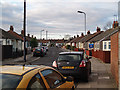

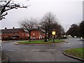
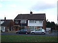
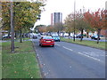
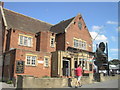
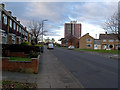
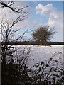
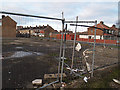
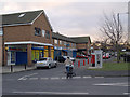
14 photos from this area
Area Information
Key information about the TS3 0DN including its size, population, and administrative classification.
- Area Type
- Postcode
- Area Size
- 8529 m²
- Population
- 1655
- Population Density
- 5468 people/km²
House Prices in TS3 0DN
27
Properties
£56,083
Average Sold Price
£19,000
Lowest Price
£105,000
Highest Price
Showing 27 properties
| Address | Type | Beds | Baths | Last Sale Price | Last Sale Date | |
|---|---|---|---|---|---|---|
| 6 Netherby Green, Middlesbrough, TS3 0DN | house | - | - | £90,000 | Aug 2023 | |
| 15 Netherby Green, Middlesbrough, TS3 0DN | house | - | - | £105,000 | Nov 2021 | |
| 28 Netherby Green, Middlesbrough, TS3 0DN | Semi-detached | 3 | 1 | £80,000 | Oct 2021 | |
| 14 Netherby Green, Middlesbrough, TS3 0DN | house | - | - | £66,000 | Sep 2016 | |
| 2 Netherby Green, Middlesbrough, TS3 0DN | Semi-detached | 2 | 1 | £50,000 | Jan 2016 | |
| 21 Netherby Green, Middlesbrough, TS3 0DN | Terraced | 3 | - | £58,000 | Apr 2013 | |
| 24 Netherby Green, Middlesbrough, TS3 0DN | Semi-detached | - | - | £70,000 | Dec 2004 | |
| 32 Netherby Green, Middlesbrough, TS3 0DN | Semi-detached | - | - | £37,000 | Oct 2002 | |
| 11 Netherby Green, Middlesbrough, TS3 0DN | Semi-detached | - | - | £31,000 | Apr 2002 | |
| 17 Netherby Green, Middlesbrough, TS3 0DN | Semi-detached | - | - | £46,000 | Sep 2001 |
Page 1 of 3
Energy Efficiency in TS3 0DN
Amenities
Schools
| Rank | School | Type | Entry gender | Ages |
|---|
Explore more schools in this area
Go to Schools tabDemographics
Household Size
One person
most common
Accommodation Type
Houses
most common
Tenure
29
majority
Ethnic Group
White
most common
Religion
N/A
most common
Household Composition
N/A
most common
Age
47
median
Adults (30-64 years)
most common
Household Deprivation
N/A
with no deprivation
NS-SEC
8
in Lower managerial occupations
Explore more demographic insights in this area
Go to Demographics tabPlanning
Planning Constraints
- Flood RiskPremium
- Ramsar Wetland SitesPremium
- Area of Outstanding Natural BeautyPremium
- Protected Nature ReservePremium
- Protected WoodlandPremium