Area Overview for TS29 6HU
Photos of TS29 6HU
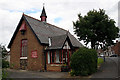
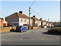
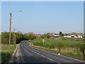
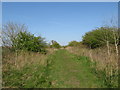
13 photos from this area
Area Information
Key information about the TS29 6HU including its size, population, and administrative classification.
- Area Type
- Postcode
- Area Size
- 8.1 hectares
- Population
- 1776
- Population Density
- 433 people/km²
House Prices in TS29 6HU
37
Properties
£155,725
Average Sold Price
£49,950
Lowest Price
£320,000
Highest Price
Showing 37 properties
| Address | Type | Beds | Baths | Last Sale Price | Last Sale Date | |
|---|---|---|---|---|---|---|
| 37 Harwood Court, Trimdon Grange, TS29 6HU | Terraced | 3 | 1 | £61,000 | Aug 2025 | |
| 21 Harwood Court, Trimdon Grange, TS29 6HU | Detached | 4 | 2 | £265,000 | Nov 2024 | |
| 30 Harwood Court, Trimdon Grange, TS29 6HU | Bungalow | 6 | 3 | £300,000 | Apr 2024 | |
| 8 Harwood Court, Trimdon Grange, TS29 6HU | Terraced | 3 | 1 | £119,000 | Jan 2023 | |
| 20 Harwood Court, Trimdon Grange, TS29 6HU | house | - | - | £320,000 | Sep 2022 | |
| 28 Harwood Court, Trimdon Grange, TS29 6HU | Bungalow | - | - | £205,000 | Aug 2021 | |
| 2 Harwood Court, Trimdon Grange, TS29 6HU | Bungalow | - | - | £115,000 | May 2021 | |
| 35 Harwood Court, Trimdon Grange, TS29 6HU | house | - | - | £100,000 | Sep 2019 | |
| 11 Harwood Court, Trimdon Grange, TS29 6HU | Semi-detached | 3 | 1 | £148,000 | Oct 2018 | |
| 36 Harwood Court, Trimdon Grange, TS29 6HU | house | - | - | £71,000 | Sep 2018 |
Page 1 of 4
Energy Efficiency in TS29 6HU
Amenities
Schools
| Rank | School | Type | Entry gender | Ages |
|---|
Explore more schools in this area
Go to Schools tabDemographics
Household Size
Two person
most common
Accommodation Type
Houses
most common
Tenure
65
majority
Ethnic Group
White
most common
Religion
N/A
most common
Household Composition
N/A
most common
Age
47
median
Adults (30-64 years)
most common
Household Deprivation
N/A
with no deprivation
NS-SEC
19
in Lower managerial occupations
Explore more demographic insights in this area
Go to Demographics tabPlanning
Planning Constraints
- Flood RiskPremium
- Ramsar Wetland SitesPremium
- Area of Outstanding Natural BeautyPremium
- Protected Nature ReservePremium
- Protected WoodlandPremium