Area Overview for TS28 5HP
Photos of TS28 5HP
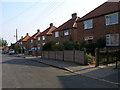
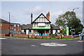
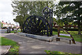

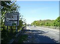

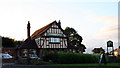
11 photos from this area
Area Information
Key information about the TS28 5HP including its size, population, and administrative classification.
- Area Type
- Postcode
- Area Size
- 15.7 hectares
- Population
- 1922
- Population Density
- 1626 people/km²
House Prices in TS28 5HP
24
Properties
£135,091
Average Sold Price
£20,279
Lowest Price
£255,000
Highest Price
Showing 24 properties
| Address | Type | Beds | Baths | Last Sale Price | Last Sale Date | |
|---|---|---|---|---|---|---|
| 5 Durham Road, Wingate, TS28 5HP | Detached | 3 | 1 | £155,000 | Apr 2025 | |
| 2 Durham Road, Wingate, TS28 5HP | house | - | - | £100,000 | Mar 2025 | |
| Wynhurst, Durham Road, Wingate, TS28 5HP | Detached | 3 | 1 | £255,000 | Aug 2024 | |
| Alderwood, Durham Road, Wingate, TS28 5HP | Detached | 5 | 2 | £249,950 | Oct 2020 | |
| Ballintoy, Durham Road, Wingate, TS28 5HP | house | - | - | £160,000 | Jan 2020 | |
| Woodlands, Durham Road, Wingate, TS28 5HP | house | - | - | £183,000 | Oct 2019 | |
| 6 Durham Road, Wingate, TS28 5HP | Detached | 3 | 1 | £125,000 | Mar 2019 | |
| Cestria, Durham Road, Wingate, TS28 5HP | Semi-detached | 3 | - | £152,000 | Mar 2019 | |
| Clifton House, Durham Road, Wingate, TS28 5HP | house | - | - | £149,999 | Nov 2007 | |
| Heortnesse, Durham Road, Wingate, TS28 5HP | Terraced | - | - | £125,000 | Dec 2006 |
Page 1 of 3
Energy Efficiency in TS28 5HP
Amenities
Schools
| Rank | School | Type | Entry gender | Ages |
|---|
Explore more schools in this area
Go to Schools tabDemographics
Household Size
Two person
most common
Accommodation Type
Houses
most common
Tenure
78
majority
Ethnic Group
White
most common
Religion
N/A
most common
Household Composition
N/A
most common
Age
47
median
Adults (30-64 years)
most common
Household Deprivation
N/A
with no deprivation
NS-SEC
31
in Lower managerial occupations
Explore more demographic insights in this area
Go to Demographics tabPlanning
Planning Constraints
- Flood RiskPremium
- Ramsar Wetland SitesPremium
- Area of Outstanding Natural BeautyPremium
- Protected Nature ReservePremium
- Protected WoodlandPremium