Area Overview for TS26 8AR
Photos of TS26 8AR
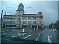
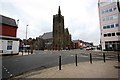

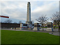
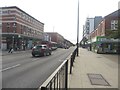
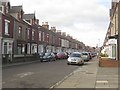
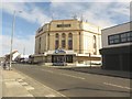
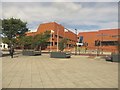
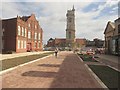
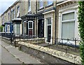
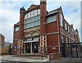
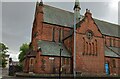
65 photos from this area
Area Information
Key information about the TS26 8AR including its size, population, and administrative classification.
- Area Type
- Postcode
- Area Size
- 2897 m²
- Population
- 1941
- Population Density
- 6987 people/km²
House Prices in TS26 8AR
19
Properties
£436,004
Average Sold Price
£10,000
Lowest Price
£4,970,000
Highest Price
Showing 19 properties
| Address | Type | Beds | Baths | Last Sale Price | Last Sale Date | |
|---|---|---|---|---|---|---|
| 11 York Road, Hartlepool, TS26 8AR | Terraced | 4 | 1 | £55,350 | Sep 2024 | |
| 33 York Road, Hartlepool, TS26 8AR | house | - | - | £135,000 | Sep 2022 | |
| 37 York Road, Hartlepool, TS26 8AR | retail_financial | - | - | £4,970,000 | Jun 2022 | |
| 19 York Road, Hartlepool, TS26 8AR | Terraced | 4 | 1 | £73,000 | Jan 2022 | |
| 27 York Road, Hartlepool, TS26 8AR | Terraced | 3 | 1 | £41,800 | Aug 2021 | |
| 13 York Road, Hartlepool, TS26 8AR | Flat | 1 | 1 | £41,000 | Oct 2012 | |
| 35 York Road, Hartlepool, TS26 8AR | Terraced | 4 | 1 | £85,000 | Feb 2008 | |
| 31 York Road, Hartlepool, TS26 8AR | house | - | - | £69,900 | Apr 2007 | |
| 29 York Road, Hartlepool, TS26 8AR | house | 4 | - | £73,000 | Aug 2004 | |
| 21 York Road, Hartlepool, TS26 8AR | Terraced | 4 | 1 | £67,500 | Aug 2004 |
Page 1 of 2
Energy Efficiency in TS26 8AR
Amenities
Schools
| Rank | School | Type | Entry gender | Ages |
|---|
Explore more schools in this area
Go to Schools tabDemographics
Household Size
One person
most common
Accommodation Type
Houses
most common
Tenure
35
majority
Ethnic Group
White
most common
Religion
N/A
most common
Household Composition
N/A
most common
Age
47
median
Adults (30-64 years)
most common
Household Deprivation
N/A
with no deprivation
NS-SEC
13
in Lower managerial occupations
Explore more demographic insights in this area
Go to Demographics tabPlanning
Planning Constraints
- Flood RiskPremium
- Ramsar Wetland SitesPremium
- Area of Outstanding Natural BeautyPremium
- Protected Nature ReservePremium
- Protected WoodlandPremium