Area Overview for TS26 0WG
Photos of TS26 0WG
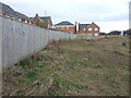
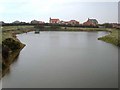
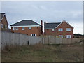
7 photos from this area
Area Information
Key information about the TS26 0WG including its size, population, and administrative classification.
- Area Type
- Postcode
- Area Size
- 1.1 hectares
- Population
- 1955
- Population Density
- 4312 people/km²
House Prices in TS26 0WG
17
Properties
£299,050
Average Sold Price
£175,700
Lowest Price
£485,000
Highest Price
Showing 17 properties
| Address | Type | Beds | Baths | Last Sale Price | Last Sale Date | |
|---|---|---|---|---|---|---|
| 10 Snowdrop Road, Hartlepool, TS26 0WG | Detached | 4 | 3 | £245,000 | Sep 2025 | |
| 32 Snowdrop Road, Hartlepool, TS26 0WG | Detached | 4 | 1 | £420,000 | May 2024 | |
| 14 Snowdrop Road, Hartlepool, TS26 0WG | Detached | 5 | 3 | £485,000 | Sep 2023 | |
| 20 Snowdrop Road, Hartlepool, TS26 0WG | Detached | 5 | 1 | £372,300 | Mar 2023 | |
| 26 Snowdrop Road, Hartlepool, TS26 0WG | Retail | 4 | 4 | £320,000 | Jul 2022 | |
| 30 Snowdrop Road, Hartlepool, TS26 0WG | house | 4 | - | £299,000 | Nov 2016 | |
| 2 Snowdrop Road, Hartlepool, TS26 0WG | Detached | 6 | 3 | £249,950 | Mar 2013 | |
| 28 Snowdrop Road, Hartlepool, TS26 0WG | house | - | - | £248,000 | May 2011 | |
| 34 Snowdrop Road, Hartlepool, TS26 0WG | Detached | - | - | £295,000 | Mar 2010 | |
| 22 Snowdrop Road, Hartlepool, TS26 0WG | Detached | 5 | 3 | £365,000 | Oct 2006 |
Page 1 of 2
Energy Efficiency in TS26 0WG
Amenities
Schools
| Rank | School | Type | Entry gender | Ages |
|---|
Explore more schools in this area
Go to Schools tabDemographics
Household Size
Family (3-5 people)
most common
Accommodation Type
Houses
most common
Tenure
79
majority
Ethnic Group
White
most common
Religion
N/A
most common
Household Composition
N/A
most common
Age
47
median
Adults (30-64 years)
most common
Household Deprivation
N/A
with no deprivation
NS-SEC
38
in Lower managerial occupations
Explore more demographic insights in this area
Go to Demographics tabPlanning
Planning Constraints
- Flood RiskPremium
- Ramsar Wetland SitesPremium
- Area of Outstanding Natural BeautyPremium
- Protected Nature ReservePremium
- Protected WoodlandPremium