Area Overview for TS26 0TY
Photos of TS26 0TY


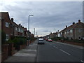
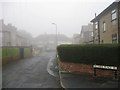


14 photos from this area
Area Information
Key information about the TS26 0TY including its size, population, and administrative classification.
- Area Type
- Postcode
- Area Size
- 4038 m²
- Population
- 2161
- Population Density
- 3470 people/km²
House Prices in TS26 0TY
11
Properties
£74,986
Average Sold Price
£17,920
Lowest Price
£119,950
Highest Price
Showing 11 properties
| Address | Type | Beds | Baths | Last Sale Price | Last Sale Date | |
|---|---|---|---|---|---|---|
| 145 Throston Grange Lane, Hartlepool, TS26 0TY | Terraced | 3 | 1 | £100,000 | May 2025 | |
| 141 Throston Grange Lane, Hartlepool, TS26 0TY | Terraced | 3 | 1 | £119,950 | Mar 2023 | |
| 137 Throston Grange Lane, Hartlepool, TS26 0TY | Terraced | 3 | 1 | £86,000 | Nov 2020 | |
| 131 Throston Grange Lane, Hartlepool, TS26 0TY | house | 3 | - | £82,000 | Dec 2016 | |
| 143 Throston Grange Lane, Hartlepool, TS26 0TY | house | - | - | £72,500 | Jul 2015 | |
| 139 Throston Grange Lane, Hartlepool, TS26 0TY | Terraced | 3 | - | £110,000 | Apr 2010 | |
| 135 Throston Grange Lane, Hartlepool, TS26 0TY | Terraced | 4 | 1 | £47,000 | Jul 2002 | |
| 147 Throston Grange Lane, Hartlepool, TS26 0TY | Semi-detached | - | - | £17,920 | Jun 2002 | |
| 149 Throston Grange Lane, Hartlepool, TS26 0TY | house | - | - | £39,500 | Aug 2000 | |
| 129 Throston Grange Lane, Hartlepool, TS26 0TY | Terraced | - | - | - | - |
Page 1 of 2
Energy Efficiency in TS26 0TY
Amenities
Schools
| Rank | School | Type | Entry gender | Ages |
|---|
Explore more schools in this area
Go to Schools tabDemographics
Household Size
One person
most common
Accommodation Type
Houses
most common
Tenure
48
majority
Ethnic Group
White
most common
Religion
N/A
most common
Household Composition
N/A
most common
Age
47
median
Adults (30-64 years)
most common
Household Deprivation
N/A
with no deprivation
NS-SEC
19
in Lower managerial occupations
Explore more demographic insights in this area
Go to Demographics tabPlanning
Planning Constraints
- Flood RiskPremium
- Ramsar Wetland SitesPremium
- Area of Outstanding Natural BeautyPremium
- Protected Nature ReservePremium
- Protected WoodlandPremium