Area Overview for TS26 0TL
Photos of TS26 0TL
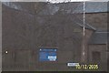
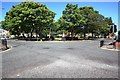
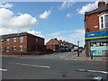
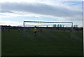
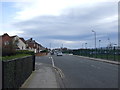
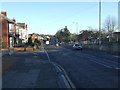
8 photos from this area
Area Information
Key information about the TS26 0TL including its size, population, and administrative classification.
- Area Type
- Postcode
- Area Size
- 1.2 hectares
- Population
- 2161
- Population Density
- 3470 people/km²
House Prices in TS26 0TL
39
Properties
£80,011
Average Sold Price
£29,100
Lowest Price
£118,000
Highest Price
Showing 39 properties
| Address | Type | Beds | Baths | Last Sale Price | Last Sale Date | |
|---|---|---|---|---|---|---|
| 146 Flint Walk, Hartlepool, TS26 0TL | Terraced | 3 | 1 | £118,000 | Aug 2025 | |
| 188 Flint Walk, Hartlepool, TS26 0TL | Terraced | 3 | 1 | £87,500 | Aug 2025 | |
| 164 Flint Walk, Hartlepool, TS26 0TL | house | - | - | £83,000 | Oct 2021 | |
| 162 Flint Walk, Hartlepool, TS26 0TL | Terraced | 3 | 1 | £82,000 | May 2020 | |
| 194 Flint Walk, Hartlepool, TS26 0TL | Terraced | 3 | - | £87,000 | Apr 2015 | |
| 114 Flint Walk, Hartlepool, TS26 0TL | house | - | - | £84,995 | May 2011 | |
| 140 Flint Walk, Hartlepool, TS26 0TL | Flat | - | - | £29,100 | Dec 2008 | |
| 132 Flint Walk, Hartlepool, TS26 0TL | house | - | - | £90,000 | Nov 2004 | |
| 190 Flint Walk, Hartlepool, TS26 0TL | house | - | - | £58,500 | Sep 2003 | |
| 192 Flint Walk, Hartlepool, TS26 0TL | Terraced | 3 | 1 | - | - |
Page 1 of 4
Energy Efficiency in TS26 0TL
Amenities
Schools
| Rank | School | Type | Entry gender | Ages |
|---|
Explore more schools in this area
Go to Schools tabDemographics
Household Size
One person
most common
Accommodation Type
Houses
most common
Tenure
48
majority
Ethnic Group
White
most common
Religion
N/A
most common
Household Composition
N/A
most common
Age
47
median
Adults (30-64 years)
most common
Household Deprivation
N/A
with no deprivation
NS-SEC
19
in Lower managerial occupations
Explore more demographic insights in this area
Go to Demographics tabPlanning
Planning Constraints
- Flood RiskPremium
- Ramsar Wetland SitesPremium
- Area of Outstanding Natural BeautyPremium
- Protected Nature ReservePremium
- Protected WoodlandPremium