Area Overview for TS25 5BT
Photos of TS25 5BT
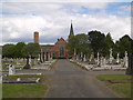
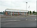
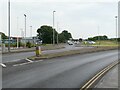
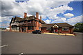
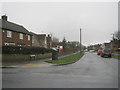

6 photos from this area
Area Information
Key information about the TS25 5BT including its size, population, and administrative classification.
- Area Type
- Postcode
- Area Size
- 8041 m²
- Population
- 1265
- Population Density
- 3703 people/km²
House Prices in TS25 5BT
48
Properties
£86,991
Average Sold Price
£35,000
Lowest Price
£169,950
Highest Price
Showing 48 properties
| Address | Type | Beds | Baths | Last Sale Price | Last Sale Date | |
|---|---|---|---|---|---|---|
| 69 Ashgrove Avenue, Hartlepool, TS25 5BT | house | 2 | 1 | £95,000 | Oct 2024 | |
| 84 Ashgrove Avenue, Hartlepool, TS25 5BT | Terraced | 3 | 1 | £89,000 | Dec 2023 | |
| 49 Ashgrove Avenue, Hartlepool, TS25 5BT | Terraced | 2 | 1 | £83,000 | Sep 2023 | |
| 56 Ashgrove Avenue, Hartlepool, TS25 5BT | Terraced | 4 | 2 | £169,950 | Oct 2022 | |
| 66 Ashgrove Avenue, Hartlepool, TS25 5BT | Terraced | 3 | 1 | £119,950 | Sep 2022 | |
| 79 Ashgrove Avenue, Hartlepool, TS25 5BT | Terraced | 3 | 1 | £84,000 | May 2021 | |
| 39 Ashgrove Avenue, Hartlepool, TS25 5BT | house | - | - | £95,000 | Aug 2020 | |
| 50 Ashgrove Avenue, Hartlepool, TS25 5BT | Terraced | 4 | 1 | £124,000 | Jul 2019 | |
| 83 Ashgrove Avenue, Hartlepool, TS25 5BT | Terraced | - | - | £79,000 | Jul 2018 | |
| 64 Ashgrove Avenue, Hartlepool, TS25 5BT | house | - | - | £85,000 | Oct 2017 |
Page 1 of 5
Energy Efficiency in TS25 5BT
Amenities
Schools
| Rank | School | Type | Entry gender | Ages |
|---|
Explore more schools in this area
Go to Schools tabDemographics
Household Size
Two person
most common
Accommodation Type
Houses
most common
Tenure
77
majority
Ethnic Group
White
most common
Religion
N/A
most common
Household Composition
N/A
most common
Age
47
median
Adults (30-64 years)
most common
Household Deprivation
N/A
with no deprivation
NS-SEC
27
in Lower managerial occupations
Explore more demographic insights in this area
Go to Demographics tabPlanning
Planning Constraints
- Flood RiskPremium
- Ramsar Wetland SitesPremium
- Area of Outstanding Natural BeautyPremium
- Protected Nature ReservePremium
- Protected WoodlandPremium