Area Overview for TS25 4NE
Photos of TS25 4NE
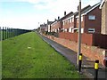
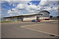
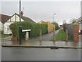
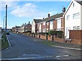
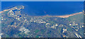
6 photos from this area
Area Information
Key information about the TS25 4NE including its size, population, and administrative classification.
- Area Type
- Postcode
- Area Size
- 7746 m²
- Population
- 1767
- Population Density
- 3675 people/km²
House Prices in TS25 4NE
30
Properties
£78,346
Average Sold Price
£44,000
Lowest Price
£100,000
Highest Price
Showing 30 properties
| Address | Type | Beds | Baths | Last Sale Price | Last Sale Date | |
|---|---|---|---|---|---|---|
| 167 Macaulay Road, Hartlepool, TS25 4NE | Terraced | 2 | 1 | £81,000 | Sep 2023 | |
| 149 Macaulay Road, Hartlepool, TS25 4NE | Terraced | 2 | 1 | £70,500 | Aug 2023 | |
| 159 Macaulay Road, Hartlepool, TS25 4NE | Terraced | 3 | - | £97,000 | Jan 2022 | |
| 42 Macaulay Road, Hartlepool, TS25 4NE | Semi-detached | 3 | - | £100,000 | Jan 2019 | |
| 153 Macaulay Road, Hartlepool, TS25 4NE | house | - | - | £80,000 | Sep 2015 | |
| 151 Macaulay Road, Hartlepool, TS25 4NE | Terraced | 4 | 1 | £70,000 | Sep 2014 | |
| 131 Macaulay Road, Hartlepool, TS25 4NE | Terraced | - | - | £80,000 | Mar 2007 | |
| 163 Macaulay Road, Hartlepool, TS25 4NE | Terraced | - | - | £90,000 | Nov 2006 | |
| 143 Macaulay Road, Hartlepool, TS25 4NE | house | - | - | £79,950 | Apr 2005 | |
| 161 Macaulay Road, Hartlepool, TS25 4NE | Terraced | - | - | £59,950 | Sep 2004 |
Page 1 of 3
Energy Efficiency in TS25 4NE
Amenities
Schools
| Rank | School | Type | Entry gender | Ages |
|---|
Explore more schools in this area
Go to Schools tabDemographics
Household Size
Family (3-5 people)
most common
Accommodation Type
Houses
most common
Tenure
35
majority
Ethnic Group
White
most common
Religion
N/A
most common
Household Composition
N/A
most common
Age
47
median
Adults (30-64 years)
most common
Household Deprivation
N/A
with no deprivation
NS-SEC
12
in Lower managerial occupations
Explore more demographic insights in this area
Go to Demographics tabPlanning
Planning Constraints
- Flood RiskPremium
- Ramsar Wetland SitesPremium
- Area of Outstanding Natural BeautyPremium
- Protected Nature ReservePremium
- Protected WoodlandPremium