Area Overview for TS25 2DF
Photos of TS25 2DF


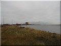
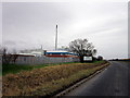
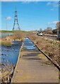
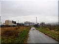
13 photos from this area
Area Information
Key information about the TS25 2DF including its size, population, and administrative classification.
- Area Type
- Postcode
- Area Size
- 94.4 hectares
- Population
- 2168
- Population Density
- 215 people/km²
House Prices in TS25 2DF
10
Properties
-
Average Sold Price
-
Lowest Price
-
Highest Price
Showing 10 properties
| Address | Type | Beds | Baths | Last Sale Price | Last Sale Date | |
|---|---|---|---|---|---|---|
| 109 Graythorp Industrial Estate Road, Hartlepool, TS25 2DF | Industrial | - | - | - | - | |
| Unit 12, Graythorp Industrial Estate Road, Hartlepool, TS25 2DF | commercial | - | - | - | - | |
| 10A Graythorp Industrial Estate Road, Hartlepool, TS25 2DF | Office | - | - | - | - | |
| Site, 77 Graythorp Industrial Estate Road, Hartlepool, TS25 2DF | office_workshop | - | - | - | - | |
| Compound 2, Graythorp Industrial Estate Road, Hartlepool, TS25 2DF | Industrial | - | - | - | - | |
| Office Block C, Works Infrastructure, 80 Graythorp Industrial Estate Road, Hartlepool, TS25 2DF | general_industrial | - | - | - | - | |
| Restoration Force Limited, 3 Graythorp Industrial Estate Road, Hartlepool, TS25 2DF | shop | - | - | - | - | |
| Turner Hire Drive, 88 Graythorp Industrial Estate Road, Hartlepool, TS25 2DF | shop | - | - | - | - | |
| J B Arkley, 107 Graythorp Industrial Estate Road, Hartlepool, TS25 2DF | shop | - | - | - | - | |
| Progress With Technology, 78 Graythorp Industrial Estate Road, Hartlepool, TS25 2DF | Industrial | - | - | - | - |
Energy Efficiency in TS25 2DF
Amenities
Schools
| Rank | School | Type | Entry gender | Ages |
|---|
Explore more schools in this area
Go to Schools tabDemographics
Household Size
Family (3-5 people)
most common
Accommodation Type
Houses
most common
Tenure
78
majority
Ethnic Group
White
most common
Religion
N/A
most common
Household Composition
N/A
most common
Age
47
median
Adults (30-64 years)
most common
Household Deprivation
N/A
with no deprivation
NS-SEC
34
in Lower managerial occupations
Explore more demographic insights in this area
Go to Demographics tabPlanning
Planning Constraints
- Flood RiskPremium
- Ramsar Wetland SitesPremium
- Area of Outstanding Natural BeautyPremium
- Protected Nature ReservePremium
- Protected WoodlandPremium