Area Overview for TS25 1UX
Photos of TS25 1UX

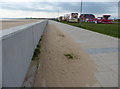
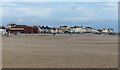
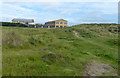
55 photos from this area
Area Information
Key information about the TS25 1UX including its size, population, and administrative classification.
- Area Type
- Postcode
- Area Size
- 1.2 hectares
- Population
- 2168
- Population Density
- 215 people/km²
House Prices in TS25 1UX
16
Properties
£162,823
Average Sold Price
£80,950
Lowest Price
£250,000
Highest Price
Showing 16 properties
| Address | Type | Beds | Baths | Last Sale Price | Last Sale Date | |
|---|---|---|---|---|---|---|
| 16 Rectory Way, Hartlepool, TS25 1UX | Retail | 4 | 2 | £240,000 | Dec 2021 | |
| 4 Rectory Way, Hartlepool, TS25 1UX | Detached | 4 | 2 | £195,000 | Mar 2021 | |
| 11 Rectory Way, Hartlepool, TS25 1UX | Detached | 4 | 1 | £235,000 | Aug 2019 | |
| 10 Rectory Way, Hartlepool, TS25 1UX | Detached | 4 | 2 | £170,000 | Oct 2016 | |
| 8 Rectory Way, Hartlepool, TS25 1UX | house | 4 | - | £182,000 | Oct 2015 | |
| 14 Rectory Way, Hartlepool, TS25 1UX | Detached | 3 | - | £175,000 | Nov 2013 | |
| 1 Rectory Way, Hartlepool, TS25 1UX | house | - | - | £182,000 | Aug 2013 | |
| 3 Rectory Way, Hartlepool, TS25 1UX | house | 1 | 3 | £145,000 | May 2012 | |
| 7 Rectory Way, Hartlepool, TS25 1UX | Detached | - | - | £220,000 | Nov 2006 | |
| 5 Rectory Way, Hartlepool, TS25 1UX | Detached | - | - | £105,000 | Jul 2001 |
Page 1 of 2
Energy Efficiency in TS25 1UX
Amenities
Schools
| Rank | School | Type | Entry gender | Ages |
|---|
Explore more schools in this area
Go to Schools tabDemographics
Household Size
Family (3-5 people)
most common
Accommodation Type
Houses
most common
Tenure
78
majority
Ethnic Group
White
most common
Religion
N/A
most common
Household Composition
N/A
most common
Age
47
median
Adults (30-64 years)
most common
Household Deprivation
N/A
with no deprivation
NS-SEC
34
in Lower managerial occupations
Explore more demographic insights in this area
Go to Demographics tabPlanning
Planning Constraints
- Flood RiskPremium
- Ramsar Wetland SitesPremium
- Area of Outstanding Natural BeautyPremium
- Protected Nature ReservePremium
- Protected WoodlandPremium