Area Overview for TS24 8NB
Photos of TS24 8NB
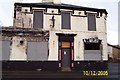
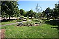
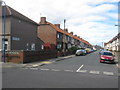
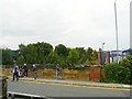

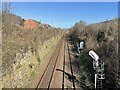
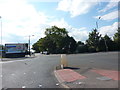
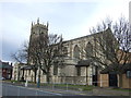
21 photos from this area
Area Information
Key information about the TS24 8NB including its size, population, and administrative classification.
- Area Type
- Postcode
- Area Size
- 1.1 hectares
- Population
- 1299
- Population Density
- 4495 people/km²
House Prices in TS24 8NB
14
Properties
£61,892
Average Sold Price
£23,400
Lowest Price
£120,000
Highest Price
Showing 14 properties
| Address | Type | Beds | Baths | Last Sale Price | Last Sale Date | |
|---|---|---|---|---|---|---|
| 76 Milbank Road, Hartlepool, TS24 8NB | house | - | - | £57,000 | Aug 2021 | |
| 73 Milbank Road, Hartlepool, TS24 8NB | Semi-detached | 3 | 1 | £82,500 | Aug 2018 | |
| 81 Milbank Road, Hartlepool, TS24 8NB | house | - | - | £120,000 | Oct 2007 | |
| 77 Milbank Road, Hartlepool, TS24 8NB | Terraced | - | - | £62,950 | May 2004 | |
| 87 Milbank Road, Hartlepool, TS24 8NB | Terraced | - | - | £23,400 | Apr 2004 | |
| 74 Milbank Road, Hartlepool, TS24 8NB | Terraced | - | - | £25,500 | Apr 2001 | |
| 69 Milbank Road, Hartlepool, TS24 8NB | house | - | - | - | - | |
| 72 Milbank Road, Hartlepool, TS24 8NB | house | - | - | - | - | |
| 75 Milbank Road, Hartlepool, TS24 8NB | house | - | - | - | - | |
| 85 Milbank Road, Hartlepool, TS24 8NB | house | - | - | - | - |
Page 1 of 2
Energy Efficiency in TS24 8NB
Amenities
Schools
| Rank | School | Type | Entry gender | Ages |
|---|
Explore more schools in this area
Go to Schools tabDemographics
Household Size
One person
most common
Accommodation Type
Houses
most common
Tenure
39
majority
Ethnic Group
White
most common
Religion
N/A
most common
Household Composition
N/A
most common
Age
47
median
Adults (30-64 years)
most common
Household Deprivation
N/A
with no deprivation
NS-SEC
14
in Lower managerial occupations
Explore more demographic insights in this area
Go to Demographics tabPlanning
Planning Constraints
- Flood RiskPremium
- Ramsar Wetland SitesPremium
- Area of Outstanding Natural BeautyPremium
- Protected Nature ReservePremium
- Protected WoodlandPremium